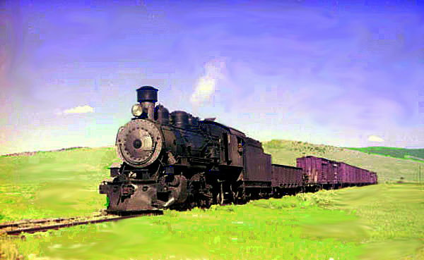
Engine No. 8, near North Gate, Colorado, approx. 1942.
 The names of the stations served by
the railway in the 1030's are indicated by the schedule to the left. The nature of the stations and
their history, give suggestions as to the ultimate fate of the Laramie, Hahn's Peak & Pacifc Railway under its various names.
By the time of the above image the railway operated under the name "Laramie, North Park & Western." The Railway and the
communities it served was a mutual symbiotic relationship; that is both needed the other to survive. As the communities grew, the railway
succeed, and as the communities failed, so did the railway.
Most of the stations have disappeared.
Coming out of Laramie, the railroad crossed the Laramie Plains giving rise to the
company's unofficial name, "The Laramie Plains Line." The first station west of Laramie was Overland which marked where the tracks crossed the old
Overland Trail. Millbrook was named after a ranch which took its name from Mill Creek which in turn took its name from a
sawmill. Hatton was the site of a ranch owned James Dougherty (1832-1918). Dougherty came to Albany County as a
freighter and served as postmaster at Hatton during the Cleveland Administration. Fillmore was named after Luther Fillmore,
a rancher who was a former
official of the Union Pacific and later in California the Southern Pacific Coast line. Henry T. Williams'
the Pacific Tourist described Fillmore as "a side track in the midst of a barren, broken country". The names of the stations served by
the railway in the 1030's are indicated by the schedule to the left. The nature of the stations and
their history, give suggestions as to the ultimate fate of the Laramie, Hahn's Peak & Pacifc Railway under its various names.
By the time of the above image the railway operated under the name "Laramie, North Park & Western." The Railway and the
communities it served was a mutual symbiotic relationship; that is both needed the other to survive. As the communities grew, the railway
succeed, and as the communities failed, so did the railway.
Most of the stations have disappeared.
Coming out of Laramie, the railroad crossed the Laramie Plains giving rise to the
company's unofficial name, "The Laramie Plains Line." The first station west of Laramie was Overland which marked where the tracks crossed the old
Overland Trail. Millbrook was named after a ranch which took its name from Mill Creek which in turn took its name from a
sawmill. Hatton was the site of a ranch owned James Dougherty (1832-1918). Dougherty came to Albany County as a
freighter and served as postmaster at Hatton during the Cleveland Administration. Fillmore was named after Luther Fillmore,
a rancher who was a former
official of the Union Pacific and later in California the Southern Pacific Coast line. Henry T. Williams'
the Pacific Tourist described Fillmore as "a side track in the midst of a barren, broken country".
Yet, as one traces the course of the line, remains of the road remain. One might be
impressed with the engineering that when into construction of the line which in Colorado might have warranted construction
as a narrow guage. Near Hatton, one may still see the Hatton Trestle.
Nearby are the foundation stones of one of the water tanks.
South of Spring Creek the railroad entered the Medicine Bows. Near Albany, the railroad made a series
of "mule shoe" curves as it ascended the mountains. The roadbed near Albany station still is visible as it climbs the
steep slope.

LHP&P entering a curve near Albany Station, approx. 1911.
In one area there was a stretch where it took
seven miles to go what whould have been 1.4 miles in a straight line. One loop was over a mile long and ended only a short distance from
its beginning. There was one fifty-foot high fill section. There were 12 degree curves.
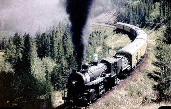
Excursion train on curve near Albany, approx. 1956.
At Albany the railway crossed the South Fork of the Little Laramie. South of
Albany the railroad passed Lake Owen, named for surveyor William O. Owen. For discussion of Owen, see
The Ascent of Grand Teton.

Train heading north along west bank of Lake Owen, approx. 1911.
At Wyocolo, the railroad crossed into Colorado.
Train, Engine No. 8 near Wyocolo, approx. 1942. Photo by Otto Perry.
Otto Perry (1894-1970) worked for the Denver Post Office, but whose avocation was the documentation
of railroad locomotives through photographs. The Denver Public Library holds a large collection of his
photographs.
At one time, Wyocolo had a log depot on the south side of the tracks. The depot burned in the
1930's. Its site is now
an open field. Nearby was a section house. A post office operated in 1912 and 1913. The station served as a loading point for railway
ties from nearby tie camps and for cattle.
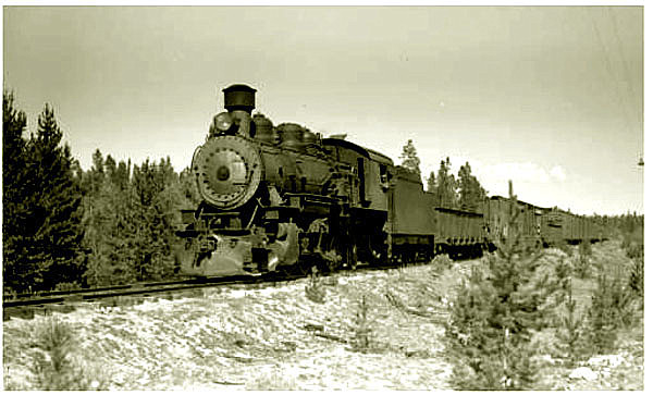
Engine No. 8 at King's Canyon, approx. 1942. Photo by Otto Perry.
As the road crossed into
Colorado south of Foxpark, the road passed through King's Canyon.

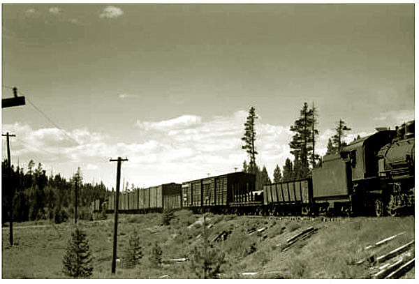
Excursion train near mile post 68, between Wyocolo and King's Canyon, 1956.
King's Canyon was a point for loading of
lumber. In the area of King's Canyon and North Gate, the railway established several stations for
loading of timber and mining products. Nearby, the Otto Lumber Company had several camps. Chief among them was
Roach several miles to the east of King's Canyon. Roach was named after the President of the Otto Lumber Company, Henry Neale "Neal" Roach (1876-1967). Gradually the
camp became generally
referred to as "Old Roach." H. N. Roach was a prominent businessman in Laramie. He served as county surveyor (1902-1906). The lumber company's principal
office was in the Roach Building, now the Wagner Building on Grand Ave., Laramie. Roach's residence
later house the Laramie Plains Museum before it moved to the Ivenson House. It later housed the Alpha Gamma Rho fratrnity.
But timber products would not
constitute a salvation for the railroad. Much of the timber from the area continued to be sent to the tie plant in Laramie by
tie drives down various creeks and waterways to the Big Laramie. One of the wonders of the
area was a tie flume.
Old Roach Flume.
Water for the flume during Spring high water was provided by by the Stuck Creek dam.

Old Roach Stuck Creek Dam, 1920's.
Old Roach was active from 1923 to 1938. At one point it attained a population of 130.
It had a school. The houses
for the inhabitants had, among other things, inside plumbing. Ties from Old Roach
were floated to the Tie Plant in Laramie Old Roach was dismantled in
1938.
The area of King's Canyon received its start when James E. Pinkham discovered gold in nearby Pinkham Creek. Pinkham
appointed as postmaster of Pinkhamton in 1879. Various efforts at mining in the area were, however,
unsuccessful because of the high cost of transportation to Laramie by freighters driving 12-horse jerkline wagons. The North Park area of Colorado until the coming of the
LLH&P was isolated from the rest of Colorado and access was from Laramie. Indeed, it was so isolated from
Colorado, that no one cared or took note of it. Indeed, the residents actually believed that they
lived in Grand County whose county seat was more convenient. To reach the seat of Larimer County one had to travel northward
to Laramie and then south to Fort Collins. Indeed, it was not until 1886 that it was finally determined in which county
North Park was located. Previously no one apparently cared. The Colorado
Supreme Court in County of Grand v. County of Larimer, 9 Colo. 268, 11 Pac 193 (1886) noted at p. 199
Much stress is laid upon the fact that, for a long period of time,
Larimer county laid no claim to the territory in dispute. But,
in this connection, it must be remembered that the North Park is
geographically isolated, and, for a long time after the passage of the
act organizing the counties of the territory, was uninhabited.
According to the testimony, it was a hunting ground for the Indians,
to which it was dangerous for the white man to resort. Whether it was
in this or that county was a neglected question, which no one was
especially interested in raising. Occupancy and settlement brought
it into notice, and gave it some civil and political importance. T
he contention for its municipal control followed close in the footsteps
of the first settlers.
Ub 1909, the Colorado Legislature solved the problem and created Jackson County. Even today, it remains small and
isolated with a population in 2010 of 1,394. Only Hinsdale, Mineral, and San Juan Counties are smaller, the latter with a
population as of 2010 of 699.
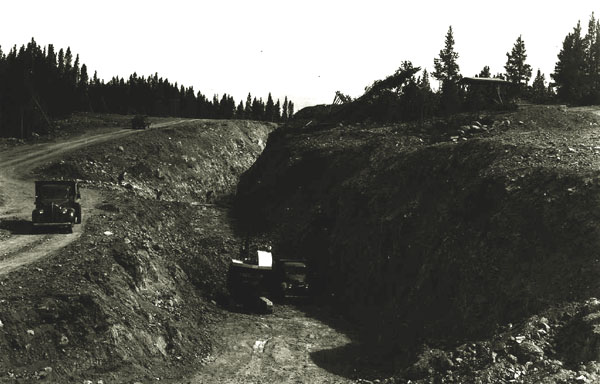
In 1909 fluorspar (calcium fluorite) was discovered in the North Park area. The coming of the railroad made mining
economically possible. Flourspar has Numerous uses in the metallurgical, ceramics, and chemical industries.
It is used in the manufacture of steel and aluminum as well as fuels such as
gaoline and uranium fuel. It has optical applications including
fiber optics and in lenses for microscopes, telescopes, and cameras.
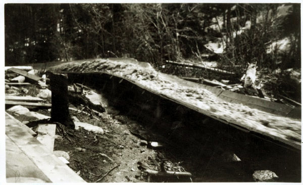
From 1911 to 1926 when the North Gate mine closed some 18,000 tons of fluorspar was shipped out.
The mine re-opened during World War II and shipped out up to 100 tons a day until the
mine again closed in 1959.

North Gate, Colorado, fluorspar Mine, 1944
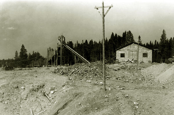
Shaft and Hoist House at the Camp Creek fluorspar Mine, North Gate, Colorado, 1944
Mine, North Gate, Colorado, 1944
Mining in North Gate declined. The United States Geological Survey noted in
in a professional paper, "Chapter G. Critical Mineral Resources of the United States":
The United States was the world’s leading producer of fluorspar until the mid-1950s.
In the mid-1970s, the U.S. fluorspar mining industry began to decline
because of foreign competition. By 1982, there was essentially only a
single U.S. producer left, and that company ceased mining in 1996.
Consumption of fluorspar in the United States peaked in the early 1970s,
which was also the peak period of U.S. steel production. Since then,
U.S. fluorspar consumption has decreased substantially; the United States
has nonetheless increased its imports of downstream fluorine compounds,
such as, in order of tonnage imported, hydrofluoric acid, aluminum fluoride,
and cryolite. This combination of no U.S. production (until recently)
and high levels of consumption has made the United States the world’s
leading fluorspar-importing country, in all its various forms.
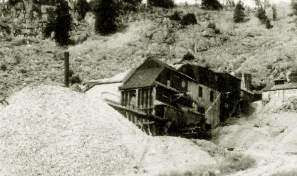
Abandoned North Gate Mine, Colorado, 1994
Today, we obtain our fluorspar from South Africa, Mexico, China, and Mongolia.
Next page: the LHP&P continued, Walden
|