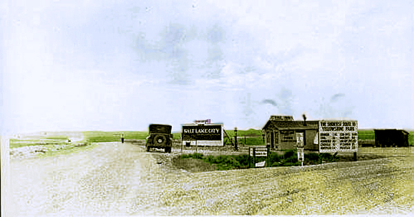
Lincoln Highway Dividing of the Ways, near Granger, 1927.
A few miles west of Little America the Lincoln Highway divided. As indicated in the
picture, to the left led to Evanston and Utah, to the right lead to Granger a short distance to the right, Yellowstone, Kemmerer and Idaho.
After the numbering system was adopted for Federal Aid Highways, the left was designated as U.S. 30S and to the right U.S. 30N.
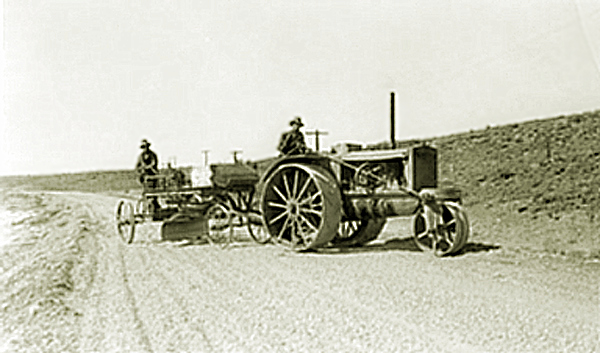
Grading of the northerly road near Granger, 1927.
With the institution of
airmail service, a short distance to the west of the intersection of the northerly and southern roads the government established an
emergency airfield.
Granger Emergency Airfield, approx. 1933.
For discussion and additional photos of emergency airmail fields, see
Cheyenne Transcontinental Airport and Rock Springs.
The immediate area of Granger near the confluence of Black's Fork and Ham's Fork has been occupied since at least the time of the so-called
"Mormon or Utah War" prior to which there was a stop on the route from the
United States to Utah. At first, the area was called "Ham's Fork" named after early mountain man Zacharias Ham, a compatriot of Ashley."
Black's Fork was also named after another member of the Ashley Pary, Arthur Black.
Early ferries were established at the location.
Horace Greeley described the area: :
�Eighteen miles [from the Green River] more of perfect desolation
brought us to the next mail company�s station on Black�s Fork, at the
junction of Ham�s Fork, two-large mill streams that rise in the mountains
south and west of this point, and run together into Green River.
They have scarcely any timber on their banks, but a sufficiency of
bushes�bitter cottonwood, willow, choke-cherry, and some others new
to me�with more grass than I have found this side of South Pass. On
these streams live several old mountaineers, who have large herds of
cattle which they are rapidly increasing by lucrative traffic with the
emigrants, who are compelled to exchange their tired, gaunt oxen and
steers for fresh ones on almost any terms.�
The name "Ham's Fork" however, possibly caused confusion with the River and with a small community about twenty miles north of Kemmerer known as "Hamsfork."
Thus by 1962, the area took on the name of Granger. There is uncertainty in the identity of the individual for whom the area was named, either Lafayette Granger
a Mormon serving under Brigham Young or Union General Gordon Granger.
Mae Urbanek in her "Wyoming Place Names," Mountain Press Publishing Company, Missoula, 1998m p, 85, writes:
"Sweetwater: first this was a stage stop garrisoned by Col. Connor [Writer's note, December 2, 1862] to protect
passengers from Indians; it was named for Gen. Gordon Granger; it was also a Pony Express station. In 1868 it became a UP railroad camp; in the 1880's it was an important railroad
junction with the Oregon Short line -- three boxcars on a siding provided the depot and waiting rooms.
Ties were floated down Ham's Fork to Granger. It was on the main travel route west, from the days of Elijah White's wagon train in 1842, until U.S. Highway 30 was moved farther south, and Little America became
Granger's rival; now it is left, quiet, on the sagerush prairies."
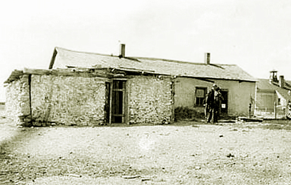
Granger Station, 1931.
A station serving Brigham Young's postal service existed nearby as early 1850. It was, however, a dugout located about four miles from
the suviving stage station. Among those serving the Mormons in the area during the Utah War was a
Lafayette Granger. An individual by the same name later served as postmaster beginning about 1868. References to the area being called "Granger," according to
John Hnekak of the Office of Archeology and Historic Preservation, National Park Service, Historic American Building Survey, HABS No. Wyo. 67, 1974, appeared as early as
1962. For additional photos and discussion of the Granger Stage Station Station, see
Stage Stations.
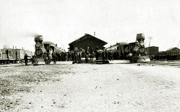
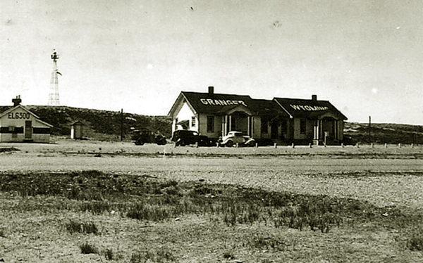
Granger Oregon Short Line Railroad Depot, November 1884, looking east.
In 1882, Granger became the junction point for the Oregon Short Line railroad. Thus, by November 1884,
not withstanding Mrs. Urbanek's comment, Granger had a proper railway
depot.
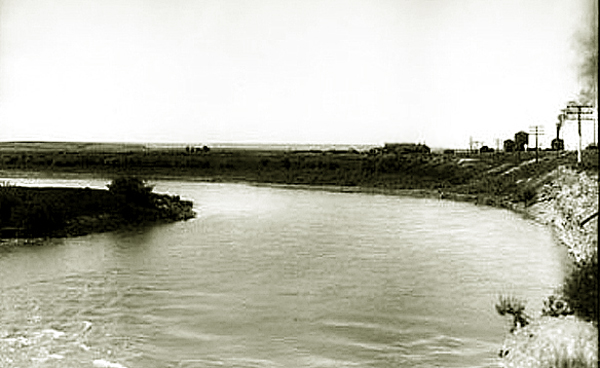
Black's Fork, with Granger in distance, 1906. Photo by J. E. Stinson.
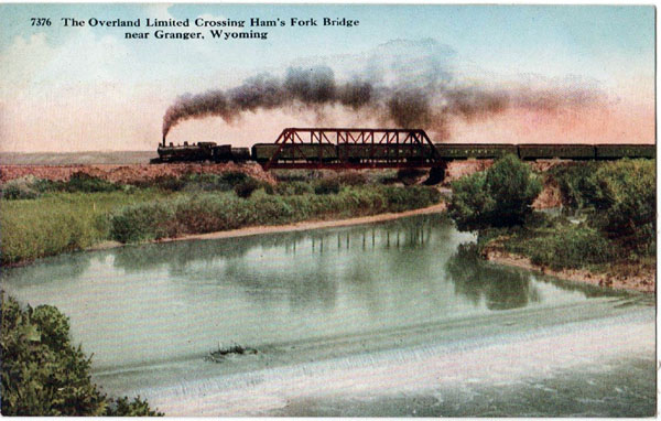
Ham's Fork Bridge, near Granger, postcard by J. E. Stinson, by J. E. Stinson, approx. 1910.
The presence of the two rivers made Granger, as noted by Mrs. Urbanek, a shipping point for railway ties floated down the river.
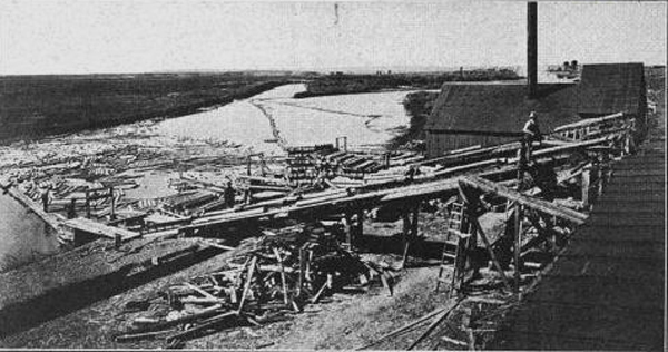
Loading Ties at Granger, undated. During the season as many as
200 men might be employed loading the ties.
For additional photos and discussion of the railroad tie industry see
Encampment,
Dubois,
Big Horn Timber Company,
McShane Log Flume and Tie Camps, and
Riverton.
With the loading of railroad ties, anticipation of increased traffic because of the designation of the Lincoln Highway, by 1917 the little town
began promoting itself at "Junction City." In 1917 J. Ernest Stinson and Lue D. Hill constructed their new 30 room Granger Hotel at a
cost of $25,000. The hotel boasted electricity, private baths, and a ballroom. When Prohibition came it, the hotel installed
a soda fountain. In response, Hugo Anderson updated his Commercial Hotel which he operated in conjunction with his "College Inn."
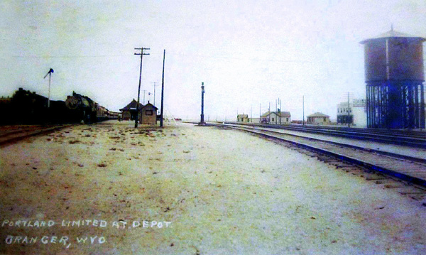
The Portland Limited at Granger Depot approx. 1928..
The Portland Limted ran from 1923 to 1930 and was succeeded by the Portland Rose. The Granger Hotel is immediately to the left of the water tank in the above image. .
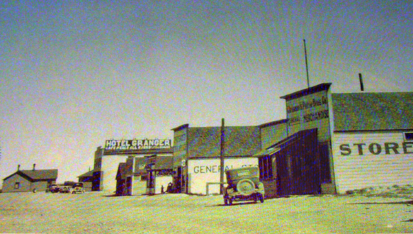
Granger, 1928.
In addition to the two hotels and the College Inn, by 1917 there were two general mercantile establishments,
Chrisman & Petrio and Bagley & Beckstead. David Baley served as Postmaster with the postoffice location in the
Bagley establshment. James W. Chrisman and James F. Petrio were the owners of the Opal Mercantile Company in Opal.
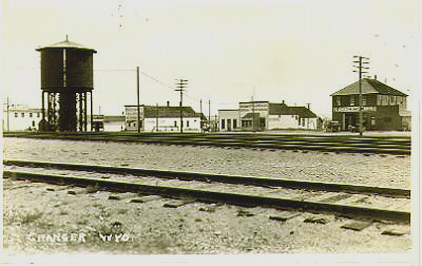
Granger, 1933.
The two-story hip roofed building is the Commercial Hotel, The two false-fronted buildings to the left of the Commerical Hotel are the
two mercantiles. The two-story building to the left of the water tank is the
Granger Hotel. In 1939, the hotel was sold and in 1940 expanded and converted into the Granger High School.
Next page: Opal on the northerly route.
|