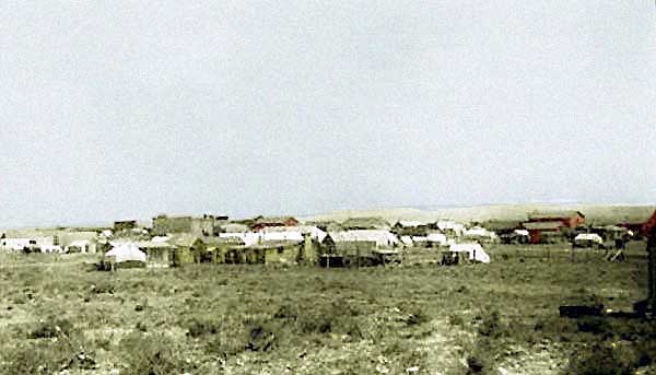
Shoshoni, Wyo., 1906
Although the Wind River Basin began to be settled as early as 1860, Shoshoni dates its founding to
1904 when laid out by the Pioneer Townsite Company, a subsidiary of the
Fremont, Elkhorn and Missouri Valley Railroad, later a part of the Chicago and Northwestern. The railroad at the time
was engaged in extending its lines westward from Casper.
The Townsite Company was responsible for founding of a number of towns in
Nebraska and South Dakota including Belle Fourche, SD, Davey, Neb. and Bruno, Neb. Many in Casper anticipated that with the extension of the Railroad westward that
Casper would become just a way station on the railroad.
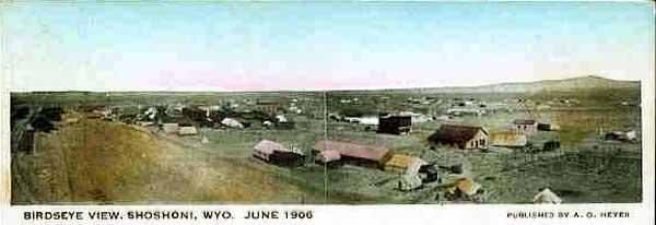
Shoshoni, Wyo., 1906
Within
a short time the area became a tent city with a population of 2,000. The growth was spurred by the opening of land within a portion of the Wind River Reservation, by exploration for minerals at nearby Copper Mountain, and
anticipation of an irrigation project and
electric power from a dam being constructed by Asmus Boysen. At the time of the opening of land within the
Wind River Reservation, Shononi boasted of 23 saloons. The Saloons included the Monogram advertised as
"Shoshoni's Leading Thirst Parlor" and the Palace operated by Oscar P. Quintrell who later served as the town's first mayor following the incorpoation of the town in April, 1906.
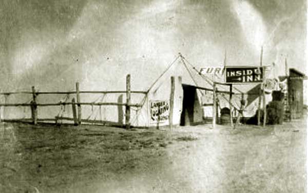
Tent real estate office and tent saloon, Shoshoni, Wyo.
In addition to saloons, other leading businesses operated out of tents. The Steam Laundry, as an example operated out of the
"Big Tent" on Wyoming Street. Even the lumber yard operated partially out of a tent.
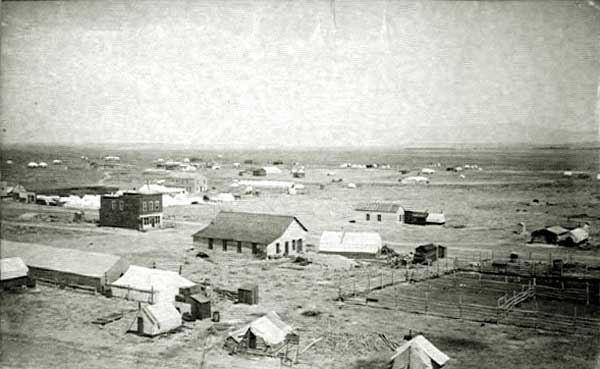
Shoshoni, Approx. 1906,
With the influx of new settlers there was a distinct shortage of housing in the new city.
The shortage of housing requiring the use of tents and crude cabins as illustrated by the next two photos.
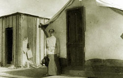 . . . . . . 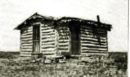
Left, Homesteader's tent house, approx. 1906; Right, First Congregational parsonage, approx. 1906. Photo by the Reverend Annette Gray
The church rented the above cabin for the use of the pastor for $8.00 a month. Later, as depicted below, the
Church was able to construct a more comfortable house. the church itself was organized in the town jail.
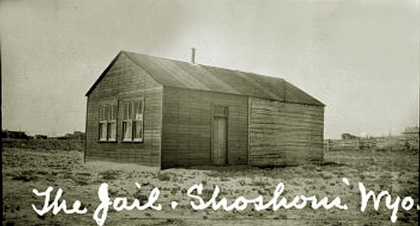
Shoshoni Town Hall and Jail, approx. 1906
Later
services were conducted in a tent until the church building could be constructed.
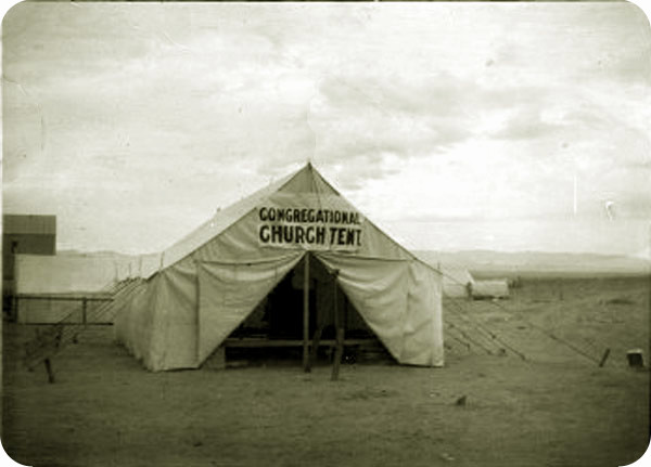
Congregational Church Tent, approx. 1906.
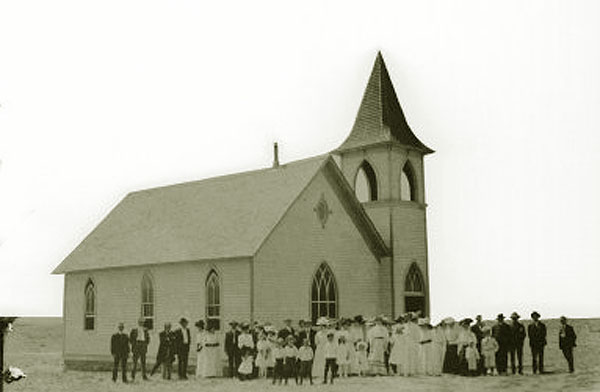
Dedication of the Congregational Church, August 1908. Photo by the Reverend Annette Gray
Folowing the dedication, the Reverend Annette Gray (Mrs. William Bradford Dodge Gray) pastor of Cheyenne's Southside
Congregational Church wrote to the Congregational Building Committee:
Now comes my burden. The good minister, Rev. Mr. [George A.] Voris, has resigned and leaves for the Coast on the 15th of September.
Why? Because the only parsonage we have is the one I photographed and enclose.
It is of logs, dirt roof, and but one room. For it we pay $8 per month. His wife is
unwilling to leave her comfortable home in Seattle and winter in that shack in the
Wyoming mountains. I cannot blame her. Mr.Voris has lived there alone for over eight months
but cannot stand it any longer. He is, and has been the only minister in Shoshoni since the
day of his coming. I cannot get another minister until I have a parsonage. There is no vacant
building to be had.
The Reverend Voris returned to Washington State and pastored the Congregational Church in Redmond, Washington in 1909 and 1910. In 1911, the Redmond church was dropped from
Congregational rolls. By 1910, the Congregation as depicted in the next photo was able to construct a more suitable parsonage.
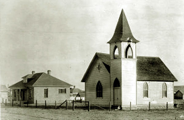
Congregational Church and Parsonage, 1910.
Of the Reverend Annette Gray, the Cleveland Plain Dealer wrote:
The only woman‘ minister who attended the conference of the National Congregational Home Missionary Society was Mrs. Annette Gray, of Cheyenne, Wyo.
Clad in khaki riding habit, Mrs. Gray goes on horseback over a parish that includes thousands of square miles in Wyoming. Her husband, the Rev. W. B. D. Gray, is in charge of fifty mission stations.
She is his only assistant. She shares his travels and his labors and
often goes on long trips alone in the mountains.
“We rode 325 miles in a wagon last summer, sleeping in tepees which had canvas floors to keep out the rattlesnakes," says Mrs. Gray.
“Another time I was on a trip by myself and found a whole town down with smallpox. Some of our
parishioners are in rough mining camps; others are clerks in village stores, or ranchers
on big places of their own. Most are men and women from the East, and many are Western reserve
people who have always lived in sight of church steeples and who welcome the opening of a little mission church.
"We need money—oh, how we do need it! We could do so much for our people if we had, say, $7,000. Just think!
In my home town, near Boston, the music on a single Sunday sometimes costs $5,000.
I don't grudge the organist and singers good pay, but it doesn’t seem just right, somehow."
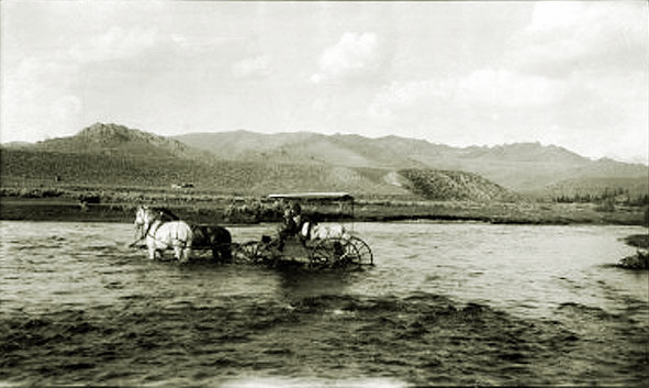
Gray Missionary Tour, approx. 1907.
In addition to the Congregational Church there was a Baptist Church and an Episcopal Church, St. Luke's. The priest for St.Luke's rode circuit srving parishioners in
Thermopolis, Riverton as well as Shoshoni. The Baptish Church had services on the second and fourth Sundays.
Next Page: Shoshoni Continued, B. H. "Barney" Aronson, Asmus Boysen, the Townside of Neble.
|