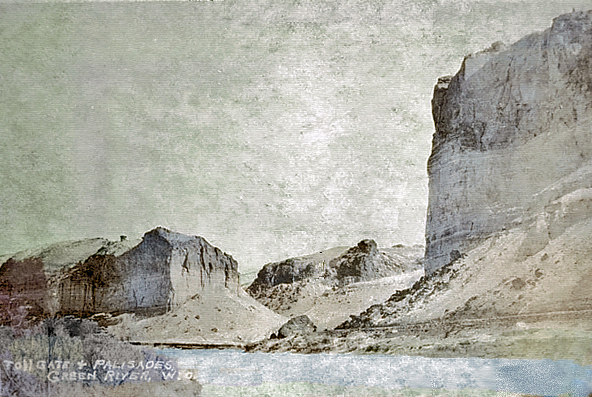
Tollgate Rock, William Henry Jackson, approx. 1900.
A short distance west of Rock Springs early travelers came to the Green River Palisades and Toll Gate Rock, other than
Yellowstone and the Grand Tetons, possibly was the most widely photographed and painted site in
Wyoming. It was the subject of multiple paintings by Thomas Moran, photographed by William Henry Jackson, and the subject
of many postcards. The result is that as depicted below one may easily see in one location the development of
roads in southern Wyoming from Indian and trapper trail to Interstate Highway and the transition from horse
to modern automobiles.
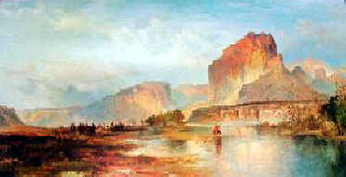
Green River Palisades, Thomas Moran, 1872, looking north.
In the next view, one may clearly see a dirt trail along the foot of the palisades. After its designation in 1913,
the Lincoln Highway near Green River originally followed the old Overland Trail through Telephone Canyon heading west from opposite Green River and
did not parallel the Green River. today, the Overland
Trail heading west from Green River is marked by a dirt trail and a pipeline. As illustrated in the following image dated about 1924, the highway was
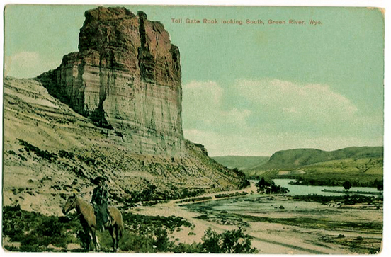
relocated along the foot of the Palisades passing in a gap between Tollgate Rock and a small hill. Allegedly the gap was constructed by early Mormons who then charged a toll for its use. The gap became known as the “Tollgate.”
Illustration, approx. 1924, of Lincoln Highway passing through the gap known as the
“Tollgate” from which the rock took its name.
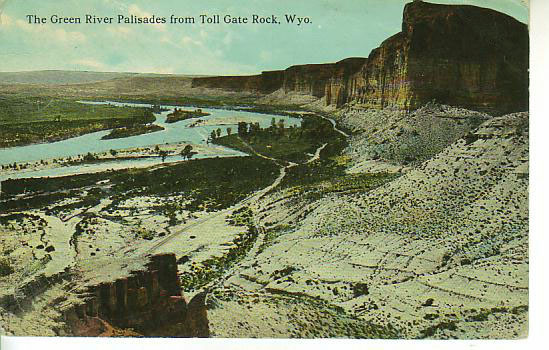
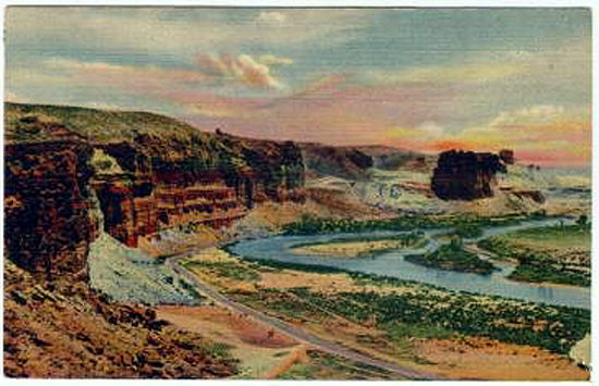
Green River Palisades looking north from Tollgate Rock, Barkalow Brothers, approx. 1910.
The Barkalow Brothers, Sidney D. Barkalow and Derrick V. Barkalow, arrived in Omaha in 1856 and with the creation of the Union Pacific Railroad became the
exclusive news agents on the trains and in the stations along the line.

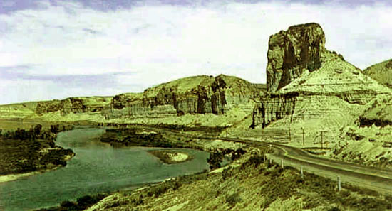
Lincoln Highway, U.S. 30, looking north, Tollgate Rock, 1930's
The highway following its relocation along the Green River as depicted was originally a 24 foot gravel road and crossed the 286 foot-long Green River Bridge, the longest
bridge on the Lincoln Highway in Wyoming.
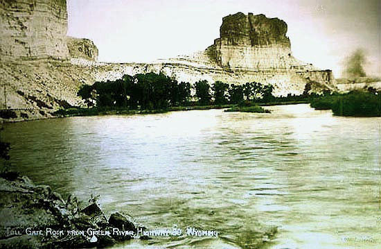
Green River and Tollgate Rock, approx. 1950.
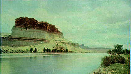
Green River and Tollgate Rock, approx. 1909.
Lincoln Highway, U.S. Highway 30 and Green River Palisades 1940's.
Green River and Tollgate Rock, approx. 1939.
In the next image, one may view at one time, the dirt trail, U.S. Highway 30, and Interstate 80 all running side by side. Note that the
Interstate now passes behind the rock.
Tollgate Rock took its name when early Mormons cut a pass next to the rock and charged a toll. Those with an
imagination may see a sleeping giant in the formation of the top of the rock, the head on the right and
arms folded on his chest.

Interstate 80, U.S. 30, at the Green River Palisades.
Next page: Lincoln Highway continued, Covey's Little America.
|