|
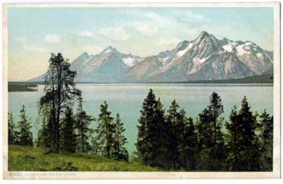
Jackson Lake, 1901. Photo by William H. Jackson.
The Gros Ventre flows into the east side of the Snake River a short distance from Menor's ferry. The Gros Ventre flows westward along the foot of the
north slope of Sheep Mountain. Sheep Mountain consists of sandstone overlying a sloped layer of shale. About 1885, seeking gold, Wilhelm Blank "Billy" Bierer (1849-1923) wandered into
the valley. Gradually, about 3 1/2 miles down stream from Sheep Mountain, a small town named Grovont arose. Grovont is an anglicized spelling of the French
pronunication of Gros Ventre. In 1909, a post office was established. To avoid confusion with another location on Mormon Row about two miles away,
the town was renamed Kelly after William J. "Bill" Kelly a local rancher. Bierer gave up mining and turned to homesteading. He also acted as as a guide for bear hunters. He proved up his homestead claim in 1915, At his homestead, Bierer would occasionally hear disturbing
noises coming from the cliffs of sheep mountain. In 1920, Bierer sold out to
Thomas G. "Guil" Huff. Bierer returned to his native Pennsylvania. Kelly continued to grow and had a hotel, school, livery, and an Episcopal Church and
associated rectory. Huff with his wife moved into a homestead established on the choice bottomlands of
the Gross Ventre about a mile west of Horsetail Creek. At horsetail creek was a ranger station.
On the afternoon of June 23, 1925, Guil Huff was herding a small number of cattle. It had rained for the previous two weeks.
The rain increased the speed of the snowmelt from the previous winter. In the distance, Guil heard a rumble. Turning around,
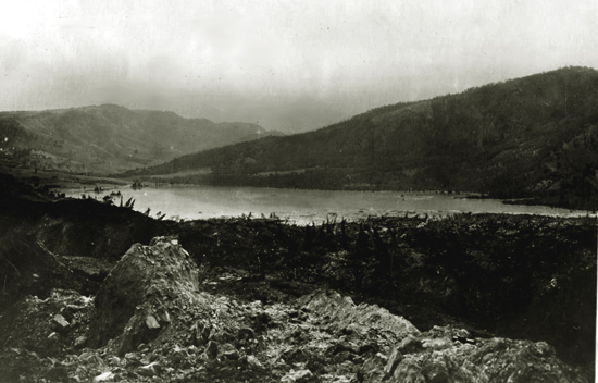
he saw a wall of rock thundering down the north side of sheep mountain. In the ride of his life, Guil spurred his horse into full gallop. Horse and rider escaped
the on-rushing 50,000,000 cubic yards of rock by a mere twenty feet. The slide swept across the river, up the other slope, and back
down, forming a natural dam across the river 200 feet high and 120 feet wide.
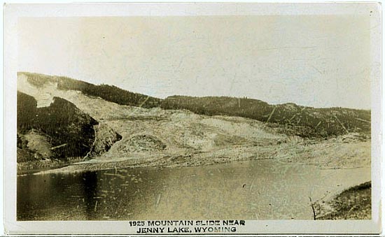
Gros Ventre Landslide.
Gros Ventre Landslide.
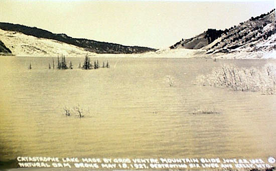
With the river blocked, water behind the natural dam began to rise. By 4:00 a.m. the next morning, the Huff homestead began to flood. Within three days thereafter,
it was floating in the newly formed lake.
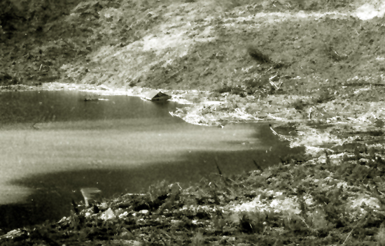
Guil Huff's House floating in newly formed lake.
Within days, the Horsetail Creek Ranger Station was innudated. With seepage through
the natural dam, the water ultimately obtained equalibrium without overflowing the top. Engineers inspected the dam
and pronounced it safe.
Gros Ventre Dam.
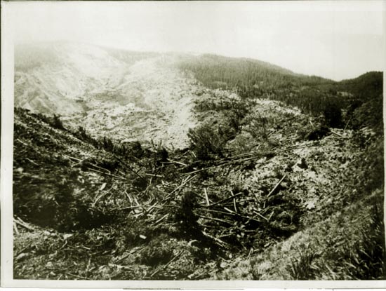
Gros Ventre Landslide.
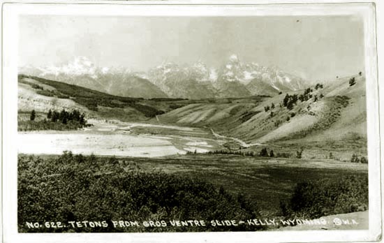
There were heavy snows in the winter of 1926-1927. In May 1927, two weeks of heavy rain came and again increased the snowmelt. The Gros
Ventre River began to rise. Brush began to catch on the newly constructed steel truss bridge at
Kelly. Thus, on May 18 men from the village were out attempting to clear the obstruction to water flow. Among them was forest ranger
Charles E. Dibble. Dibble had previously expressed concern over the stability of the natural dam. While
clearing the brush at the bridge, Dibble noticed a hayrack floating by. He and Jack Ellis decided to go up
the Gros Ventre Road to check the dam. Proceeding eastward up the road in Dibble's Ford Model T, they soon saw that water had
overflowed the top of the dam and was rapidly eroding the dam away. The dam would soon collapse.
Hastily turning the Ford around, the two sped back west down the gravel road, pausing only at a ranch house to request
a warning be telephoned to the towns of Kelly and Wilson and to cut fencing so that livestock
would not be trapped. Dibble and Ellis reached the town. Warned, the residents of Kelly began to
flee. Fifteen minutes later, a fifty-foot
high wall of water hit the town. All within the town had fled in time except seven. Max Edick and Clint Stevens found themselves trapped
on the roof of a chicken coop. Clint grabbed a hayrack and disappeared. Max ended up in the water, but was able to save himself
by grabbing a tree limb. Maude Smith and her sister May Lovejoy tried to drive away in a wagon. The horse panicked and ran into the wall
of water. Milt Kneedy disbelieved the warning. Dibble attempted to take Kneedy's foster son with him, but the
little boy ran back to his mother. The boy was last seen on the roof of a barn floating down the river. In Kelly, the only structures to survive were
the church, the rectory and the school. A portion of Wilson was also swept away.
Gros Ventre Landslide.
Expansion of the park continued in the 1950's. In the late 1950's, the Park acquired large portions of
Mormon Row about three miles south of Antelope Flats Road. Mormon Row was one of the most prosperous agricultural portions the valley.
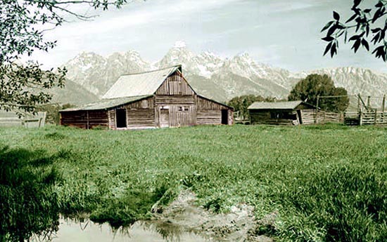
Thomas A. Moulton barn, Mormon Row
Thomas A. Moulton (1883-1966) and his brother
John A. Moulton (1887-1990) each homesteaded about 1908 in the area with their respective homesteads being proved up in 1916.
Two other brothers, Alma and Wallace also settled in the valley.
Until the homesteads were proven up, the brothers and their families spent the winters in Idaho.
The barn depicted was constructed about 1916. At one time the row had about 15 homesteads, a one-room school house, a church and a
post office.
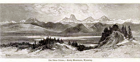
The Three Tetons, 1898.
Next page: Green River
|