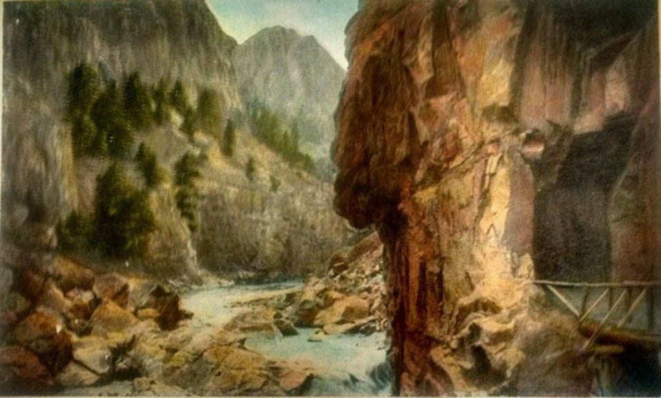
The First Tunnel, Cody Road.
Prior to about 1903, there was, as a practical matter, no access to Yellowstone from Cody.
Indeed, even though Yellowstone National Park is primarily in Wyoming, prior to 1899 the only
practical access to the Park was through Montana.
 There were a few brave souls that made the trip into Yellowstone from Cody.
In 1896, Emmaline R. Bird wrote a hand written journal entitled
"A trip through Yellowstone National
Park in 1896," edited by Charles Everling and published on the Internet, in which Mrs. Bird recounts one such pack trip
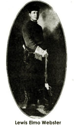
guided by William P. Webster and his 18 year old son Lewis E. "Elmo" Webster.
There were a few brave souls that made the trip into Yellowstone from Cody.
In 1896, Emmaline R. Bird wrote a hand written journal entitled
"A trip through Yellowstone National
Park in 1896," edited by Charles Everling and published on the Internet, in which Mrs. Bird recounts one such pack trip
guided by William P. Webster and his 18 year old son Lewis E. "Elmo" Webster.
Photo of Elmo, approximately 1909, to the left.
The trip proceeded south
from Cody to the Ishawooa and then followed the Ishawooa to its source and then
over a steep incline (probably Sylvan Pass) into the park. Along the Ishawooa they sometimes had
to move away from the river as the canyon was too narrow and follow a trail which was scarcely a foot wide.
It rained and the party had to go through snow to reach the park. The Websters settled on the Ishawoos in 1893. William
later was the first postmaster of Cody. His son Elmo later worked as a photographer, guide and a
wolfer before he moved to California.
Consideration of the construction of a wagon road from Wyoming into the
Park dates back as far as 1881 when Territorial Governor John W. Hoyt
visited the Park with the view of locating a route for a road into the
Park without the necessity of traveling into Idaho and Montana. Government
tends to move slowly and it was not until 1899, that a wagon road was
constructed from Fort Washakie to Yellowstone over Togwotee Pass.
Governor Hoyt in his annual report discussed a route along the North Fork
of the Stinking Water earlier explored by Capt. William A. Jones in 1873.
Governor Hoyt noted the advantages and disadvantages of the route:
It also has the advantage of leading almost at once, after crossing the
divide, to the foot of Yellowstone Lake, where the most important
improvements are likely to be placed. Nor is it wanting, along the Stinking
Water, in fine scenery, timber, or good water, for the mountains are
covered with forests, and the river, so outraged by its name, is a pure
and beautiful stream as far down as we saw it, having its sources among
the loftiest of the Sierras and being well supplied with trout. It has the
disadvantage of partly lying through a section
(between the Wind River and the Ishawooa) not well supplied with
water at all points in the dry season, of requiring many more bridges
than the Wind River route, besides a considerable amount of rock in the
canyon, and, finally, of having a much less easy grade at and near the
summit of the divide .
To go to
Yellowstone from Cody in 1903 required taking a pack train or wagon over Dead Indian Hill to Cooke City, Montana, and then
south to Yancy in Yellowstone and from there to Mammoth. Dead Indian Hill itself was rather daunting. If one used a wagon,
it became necessary to tie the wagon to trees to prevent losing the wagon down the precipice.

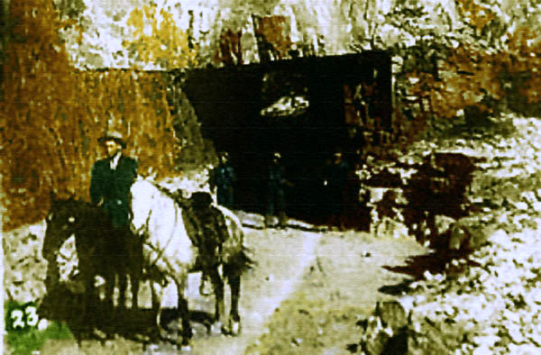
Wapiti Inn, appprox. 1909.
At the time of the construction of the dam, there was no road up Shoshone Canyon. The original road passed south of Cedar Mountain and connected with
the South Fork. It then crossed the South Fork and proceeded up the south side of the North Fork until near Wapiti until it reached the Pahaska Lodge.
At Wapiti, Colonel Cody had an interest in a hunting Lodge, the Wapiti Inn. Wapiti also had a
third-class post office. The 1903 Report of the State Game Warden listed some 11 hunting guides at Wapiti.
It was, however, not suited for
motor vehicles. Instead pack trains were used.

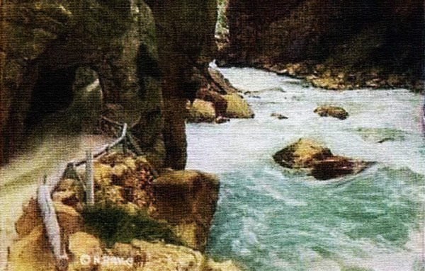
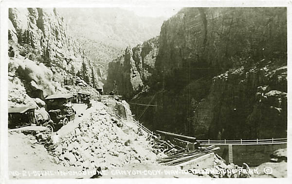
Road along the Shoshone River, 1903.
Thus,
it became necessary to even build the dam to construct of a wagon rpad and two tunnels to reach the dam site. The roadway to the dam site
required a 17% ascent up the Dam Hill grade. The road originally was for much of its disance single-lane. In the winter,
the spelling of the name of the hill in the winter sometimes changed by the addition
of an "N." Above the dam, the reservoir flooded the old road. Beginning about 1909, a new road was constructed along the north side of the reservoir connecting with the
old Cody Road near Wapiti. Above the Dam, the new road itself required five more tunnels.
Indeed, in later years before the grade was replaced by a tunnel, the Highway Department sometimes stationed a tractor at the grade to assist
mortorists whose vehicles could not make the grade. Those coming down the grade had the right-of-way and those coming up the hill might have
to back down to a wide spot or a "lay-by." It reminds the writer of a scene in
Robin Hoods' Bay on the North Yorkshire coast where he witnessed a Royal Mail van three times attempting to ascend the steep one-way street only to be required to back down as
he met another vehicle. [The writer parked his car in a car park at the top of the hill and
walked down the hill.]
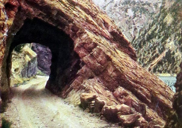
Cody Road tunnel.
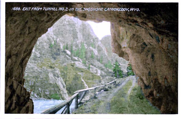
Exit from Tunnel No. 2, approx. 1910.
1910.
Tunnel No. 2 was at the approach to the Dam Hill Grade. There were a total of seven tunnels, five west of the dam.
Construction of the roadway west of the dam coincided generally with the completion of the
dam and inudation of the old Cody Road where it ran along the west side of the Shoshone. The new
Cody Road was constructed above the flood level of the Reservoir and continued on the north side of the Shoshone.
Near Wapiti the new road crossed the river and rejoined the old road. Along the reservoir additional tunnels were required.
Cody Road Tunnel, undated.
1910.
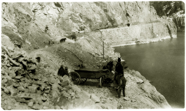
Construction of roadway tunnel, approx.
1910.
Construction of road above the dam.
approx. 1910.
Construction of roadway above the dam, approx.
1910.
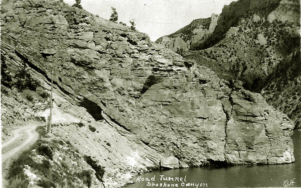
Roadway abpve the dam, approx.
1910, showing tunnel. Photo by F. J. Hiscock.
For the most part the road was one-lane which required construction of "lay-bys".
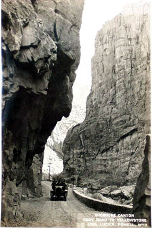 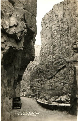
Left, a car in Shoshone Canyong. photo by A. G. Lucier. Observe the
"lay-by" on the left ahead of the car.
Right, Car parked in lay-by. Photo by F. J. Hiscock.
Not only were the two photos taken by different photographers, but based on the snow on the
mountainside on the far side of the canyon in the left photo and on the amount of water in the river, at different times of the year.
Music this page:
Where the Colubines Grow
Composed by Dr. Arthur John Fynn
As arranged by Horse Creek Cowboy
Verse 1
Where the snowy peaks gleam in the moonlight,
Above the dark forests of pine,
And the wild foaming waters dash onward,
Toward lands where the tropic stars shine;
Where the scream of the bold mountain eagle
Responds to the notes of the dove
Is the purple robed West, the land that is best,
The pioneer land that we love.
Chorus
Tis the land where the columbines grow,
Overlooking the plains far below,
While the cool summer breeze in the evergreen trees
Softly sings where the columbines grow.
Verse 2
The bison is gone from the upland,
The deer from the canyon has fled,
The home of the wolf is deserted,
The antelope moans for his dead,
The war whoop re-echoes no longer,
The Indian's only a name,
And the nymphs of the grove in their loneliness rove,
But the columbine blooms just the same.
Verse 3
Let the violet brighten the brookside,
In sunlight of earlier spring,
Let the fair clover bedeck the green meadow,
In days when the orioles sing,
Let the golden rod herald the autumn,
But, under the midsummer sky,
In its fair Western home, may the columbine bloom
Till our great mountain rivers run dry.
The Columbine, Aquilegia caerulea, referenced in the song is native to the Rocky Mountain west between Montana and
New Mexico and is generally found at elevations
of between 6,900 feet and 12,100 feet.
Next Page: Cody Road Continued.
|