Lincoln Highway at the Summit, approx. 1920 looking south.
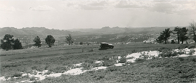
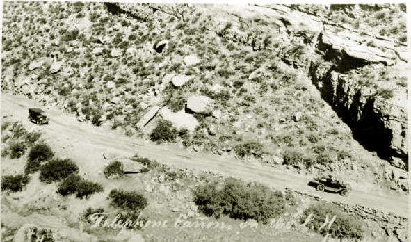
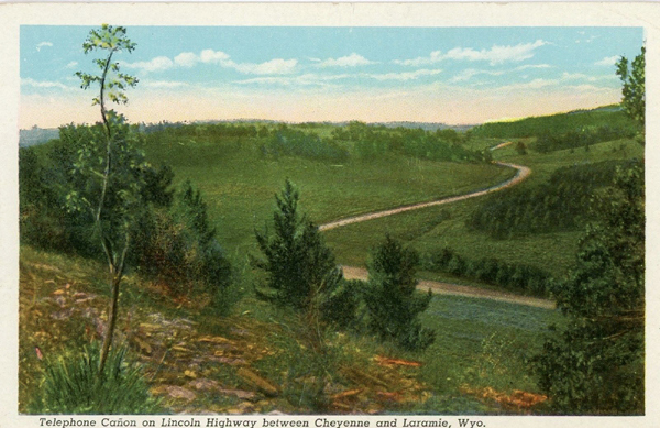
Shortly after passing the Tavern, the Lincoln Highway entered Telephone Canyon. Prior to 1915 the Lincoln Highway turned to the Southwest at Bufford toward Tie Siding. In 1916 the
highway was relocated and proceeded to the northwest through Telephone Canyon. The Canyon received its name as a
result of its being the route of the first long distance telephone line from Cheyenne to Laramie.The naming of the canyon was later marked by a plaque.
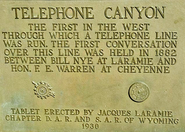
Lincoln Highway, tablet marking Telephone Canyon.
At first the canyon was known as Evans Pass named for James Evans, an engineer with the Union Pacific. See
Sherman.
At first, the Lincoln Highway headed to Laramie from Buford by way of Tie Siding.
In 1916 the highway was rerouted through the Canyon.
The Canyon previously provided a route to
Cheyenne from Laramie but it was not suitable for motor cars. It had been used by
Theodore Roosevelt on his 1903 visit to Cheyenne.
The new route through the canyon still had problems,
The disadvantage of the Telephone Canyon Route, however, was that it required the motorist to descend
1,669 feet in a distance of nine miles. In the 1920's, automobiles were primarily fitted with two-wheel, mechanical brakes. Thus, the
descent was a challenge. The highway was, additionally, only 16 feet wide. It was not until about 1922 that the grade was widened to
twenty-four feet. Indeed, even as late as the late 1930's motorists heading west were warned of blind
curves and to keep their machines in gear. The speed limit down the canyon as late as 1938 was thirty-five mile an hour.
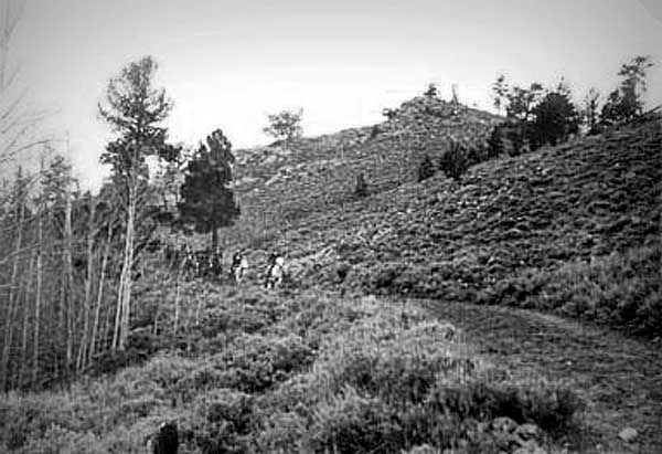
The 1903 Roosevelt party in Telephone Canyon.
In 1903, George Wyman drove from San Francisco to New York on
a motorbike. The day following Roosevelt's trek through the canyon in the area
Roosevelt had traversed, Wyman's motor bike got stuck in the gumbo. He had to
secure a team of horses to pull the 90 pound bike out of the mire. Indeed,
the mire was so thick that the bike was stuck bolt upright and did not fall over. Wyman described
the mud:
Down at the bottom I struck gumbo mud, and it stuck me. Gumbo is the mud
they use in plastering the crevices of log houses. It has the consistency
of stale mucilage and when dry is as hard as flint. It sticks better than
most friends and puts mucilage to shame. When you step in it on a grassy
spot and lift your foot the grass comes up by the roots. My wheel stood
alone in the gumbo whenever I wanted to rest, and that was pretty often.
Every time I shoved the bicycle ahead a length I had to clean the mud off
the wheels before they would turn over again. I kept this up until finally
I reached a place where I could not move the bicycle another foot.
It sunk into the gluey muck so that I could not shove it either forward or
backward.
In 1909, Alice Huyler Ramsey, the 22-year old president of the
Women's Motoring Club of New York, followed the same route in a Maxwell-Briscoe. In
Cheyenne she engaged the services of a pilot car to guide her to Laramie. The pilot car
got stuck and had to be pulled out with the Maxwell.
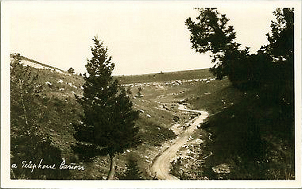
Lincoln Highway through Telephone Canyon, photo by Henning Svenson
Lincoln Highway through Telephone Canyon. photo by Henning Svenson
Telephone Canyon provided the descent to Laramie from Sherman Hill.
for more on Henning Svenson, see Laramie III. Later the
summit would be marked by a large bust of Abraham Lincoln.
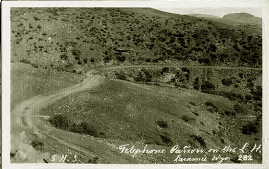
Lincoln Highway, Telephone Canyon, Sherman Hill, east of Laramie.
Even today, I-80 approximately follows this route with a five-mile long
5% grade, which in winter can be a wee bit hairy.
Lincoln Highway Telephone Canyon, 1930's, photo by
Sanborn
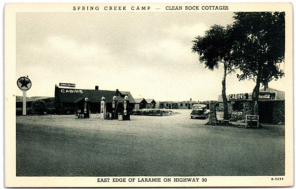
In Laramie, the Lincoln Highway proceeded west on
Grand Avenue. On the southwest corner of 30th Street, motorist in the 1930's came across an early cabin court, Texaco gas station, and cafe, "Spring Creek Camp,"
where Aspen Square is now located.
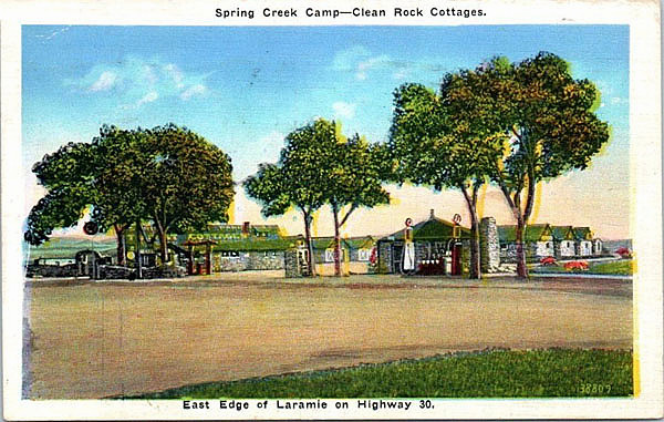
Spring Creek Camp, 1930's.
Spring Creek, a small tributary of the Big Laramie, was named by early railroad engineers.
It flowed from from several springs to the southeast of Laramie. The name lives on
in the name of an area of Laramie and the name of a school.
The camp advertised its "clean rock cabins." It achieved
some fame as being owned by the last of Wyoming's professional train robbers, William L. "Bill" Carlisle (1890-1964), the self-styled,
"White Masked Bandit." He was ultimately caught, sent to Rawlins, escaped, recaught, sentenced to 50 years, and finally in 1936 paroled
with the support of the Reverend Gerald Schellinger who served as a priest at
Rawllins' St. Joseph's and Kemmerer's St. Patrick's. After release, he first moved to Kemmerer where he
operated a newsstand and married. He moved to Laramie and at first leased and then purchased the cabin camp.
Spring Creek Camp, 1930's.
As may be noted in the above and below postcards from the changes in the gas pumps and
the cafe, the camp was gradually improved, expanded and took on the name of its owner.
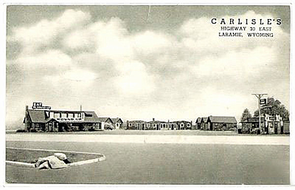
Carlisles
In 1956 the motel was sold. Shortly thereafter, it was razed and Spring Creek diverted. In 1962, Bill Carlisle's
wife died. Bill moved to Pennsylvania where he died in 1964.
Next page: Lincoln Highway continued, Laramie.
|