|
Keeline, 1915
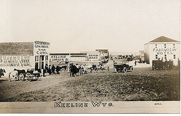
To the west of Manville, lies Keeline. Keeline originally consisted of merely
a fenced pasture and chute for the loading of sheep for the Blain Brothers sheep operation. In 1910 following the
passage of the Enlarged Hometead Act, the site was platted by A.A. Spaugh. The town was laid out with
four north-south streets and eight east-west avenues. Visitors to the town must have been
underawed by the magnificence of the railway station as to which every expense was spared.
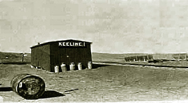
Keeline Railway Station, undated. Note the milk cans next to
the station.
Actually the purpose of the original siding was to provide a place for shipping milk to the Blue Valley
Creamery in Hasting, Nebraska. The Blue Valley Creamery had creameries scattered about the entire United states since there was
a limit in the early days as to how far the milk could be shipped. Blue Valley was at one time
the fourth largest producer of butter in the United States. In 1939 it was bought out by
was was later to become Beatrice Foods.
Like Lusk and Manville, Keeline received its
start when the Railroad came through in 1886 and was named by Spaugh after George A. Keeline whose ranch was
further to the north. George A. Keeline, originally ran cattle in
Colorado in the 1870's before he moved to Wyoming. The Keeline Ranch was headquartered in the
Thunder Basin, further to the north.
In 1914, Tom blain established the Keeline Lumber and Construction Co., capitalized at $20,000.
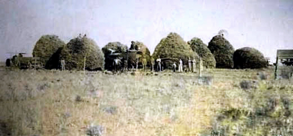
Thrashing near Keeline, undated.
With the advent of dry farming and the petroleum boom, Keeline initially had a fair growth. It achieved a
population of over four hundred. It had a bank, a store, a hotel a lumber yard which was capitalized at $20,000,
a newspaper, and the Keeline Garage which was a Chevrolet Agency.
In 1919, the Reverend W. B. Dunn, General Missionary to the Dry Farming Sections of Wyoming, wrote
optimistically of Keeline in the American Missionary:
Three or four years ago, Keeline, on the Northwestern Railroad, consisted
only of a box car which did duty for a depot, and there was nothing else
in the place which looked as if it might ever contribute toward the making
of a town. To-day Keeline is a prosperous point, with splendid agricultural
country all around it. and in response to the request of the people for
some definite church and Sunday School work, I organized a Sunday School
there on the Fourth of July of the present year. Dunn, W. B: American Missionary
"First Impresions of a General Missionary", vol. 73, p 535. (1919)
Nevertheless, the writing was on the wall. The first signs of the fading of dry farming was at Jireh which was regarded as a
center of the farming. The Bank had been moved to Keeline in 1917. Petitions were circulated to have the
railroad construct a proper terminal. But with the end of dry farming, the little town faded. A visitor in 1921, William E. Barton, described the
town as having a population of 100. He spent his two days there engaged in
"Industrious loafing admiring the blue sky, the horizon equidistant in all directions except a distant
line of hills and the gray wedge of Mount Laramie, a line of cottonwood about two or three miles away, and
read a book reclined in a haystack watching out for rattlesnakes. See Barton, Wiliam E.:
The Congregationalist, Sept. 8, 1921. Vol 106, p. 309.
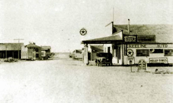
Keeline 1925.
As indicated by the next photo, little remains of Keeline. by 1986 the population had declined to four and by 1995 the postoffice had closed..
Keeline, 2005. Photo by Geoff Dobson.
To the west of Keeline in Converse County, lies the smallest incorporated
municipality in the United States, Lost Springs, population 1, 4, or 5, depending on who is
doing the counting.
The 2000 census and the road sign depicted below only reflected 1. It has been contended that
that the census taker only counted the mayor and missed the three councilmen.
The 2010 census found the missing councilmen and the sign
now indicates a population of four.
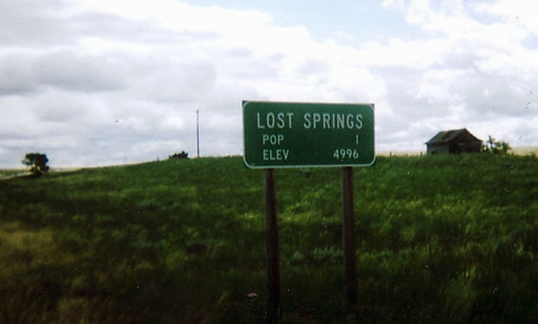
Road sign, Lost Springs, 2005. Photo by Geoff Dobson.
At one time Lost Springs had high hopes. With growth from homesteaders moving to the south of townto taking advantage of
dry farming, by 1910 the town had a lumber yard, a post office, saloon, restuarant, and a shooting
gallery. A shortline railroad was under construction to connect the Lost Spring Coal Company and the Rosin mine to the main
line at Lost Springs. By 1914 a hall was under consruction, A drug store and
mercantile had opened. There had been some setbacks. A new hotel was constructed in 1910 but unfortunately burned down in
1911. Nevertheless, soon the town had the Citizens State Bank. The railroad to the mine opened in 1914.
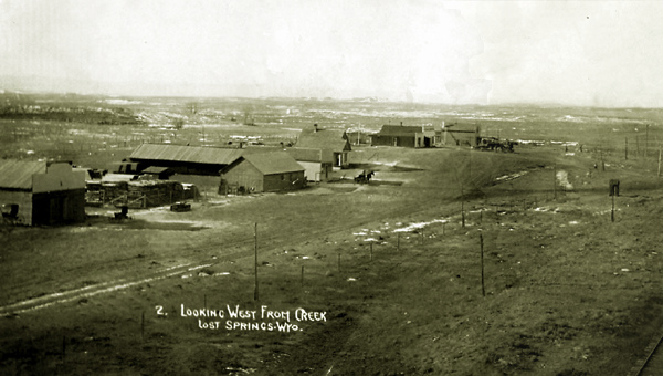
Lost Springs, approx. 1910.
The lumber yard was the O. L. Walker Lumber Company. At the time of the photo, the town did not, however, have a
blacksmith. By 1914 the town had a newspaper, the the Lost Springs Times. At its peak the town attained a population of about
150. With the completion of the shortline railroad to coal mines about nine miles away, the town was also a shipping point for
coal.
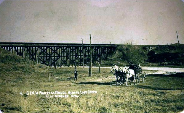
Railroad Bridge over Lost Creek, Lost Springs, 1911.
At one time, the town had a
population of about 150 and served as a shipping point for the Lost Springs Coal Company. The post office
served the area to the south where there were a number of dry farmers.
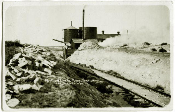
Pumping Station, Lost Creek Coal Company, Lost Springs, Approx. 1910.
In 1921, the coal mines were closed and in 1922 the railroad to the mines was abandoned.
With the end of the Lance Creek oil boom, by 1930 the population had declined to
65 and by 1940 to 38.
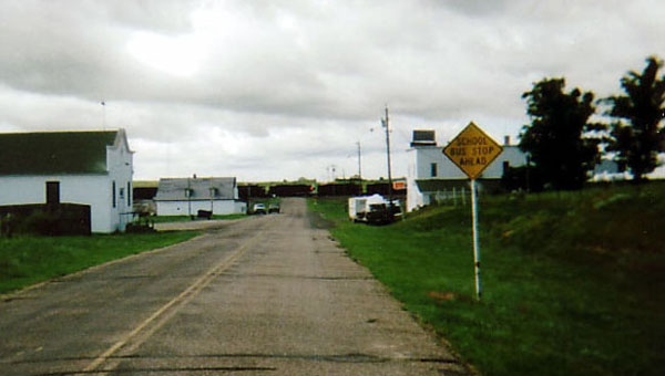
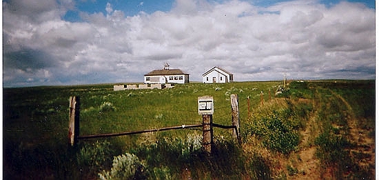
Lost Springs, looking south, 2005. Photo by Geoff Dobson.
Today, the
town consists of the Town Hall, on the left in the above photo; an antique store located in the old bank building further down the street on
the left; the "Lost Bar" saloon on the right, open on
major holidays and during hunting season; an outhouse; the old jail (not occupied during the
past 40 years); and several other
buildings in varying states of decrepitude. The coal train in the distance was over a mile long and had two
locomotive in the front and a pusher at the end.
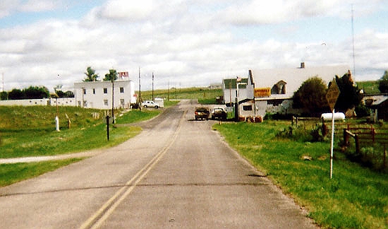
Lost Springs, looking north, 2005. Photo by Geoff Dobson.
The two story building on the left is the Lost Bar. Behind it are several
trailer houses. On the right is the post office, antigue store, and the Town Hall.
As a word of explanation, Wyoming provides revenue sharing
to its municipalities. Thus, Lost Springs receives funding from the state which has
paved its main street and helps to pay for the garbage service. The town was allegedly named by
railroad workers who were unable to find a spring shown on their maps.
|