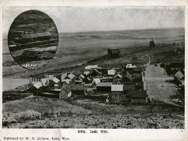
Lusk, circa 1918, looking east
On left is the Northwestern Hotel, photo on provious page. The broad street running away from
the viewer is present day East 2nd Street. It should be noted that in viewing
photos of Lusk that street names have changed.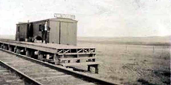
Passenger Depot, Van Tassell, Wyoming, Approx. 1910
The Fremont, Elkhorn and Missouri Valley Railroad arrived in Lusk in 1886. The arrival of the
railroad made it easy to ship cattle to Omaha. The main shipping point for
Goshen and Niobrara Counties was Van Tassell, named by the Railroad after Van Rensselaer Schuyler Van Tassell,
owner of the Jay Em south of Lusk. The Jay Em was founded by Jim Moore who later
sold the ranch to Van Tassell. After Moore's death, Van Tassell married Moore's widow.
The area presently encompassed
by Niobrara County, however, did not begin to be settled until the 1870's with the
establishment of the Sage Creek Cantonment near the old Hat Creek Road Ranch north of the
Hat Creek Breaks north of present day Lusk.
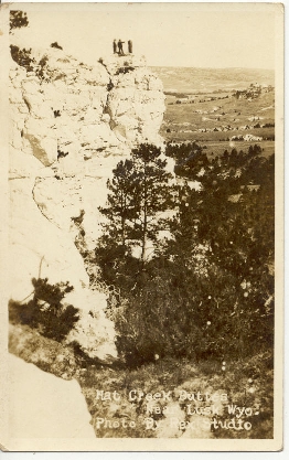
Hat Creek Butte, north of Lusk
The Hat Creek Breaks, a line of hills are, like Rawhide Buttes, an extension of a geologic formation
known as the Pine Ridge Escapment which divides the Great Plains from the rest of the
state. It was from the Breaks that early intreped travellers on
the Black Hills Stage first felt that they were really in the Black Hills. The Black
Hills received their name as a result of the ponderosa pine which from a distance seemed
black when seen in contract to the lighter chalky sedimentary rocks. Rawhide Creek was first
described by Rufus B. Sage in his description of his early 1840's trip through
the area:
This creek traces its course over a broad sandy bed, through a wide valley of rich clayey loam,
slightly timbered and luxuriant in grasses. Towards its head it is shut in upon both sides by high pine hills; but,
in passing on, these mural confines are exchanged for the prairies, and the
creek finally debouches into the Platte.
North of the Breaks on Sage Creek was the Hat Creek Station. As
noted on the previous page, there were two Hat Creek Stations, the newer one slightly
to the west of the old is still in existence. Hat Creek, itself, is in
Nebraska, but through error, Capt. Egan in establishing the fort, thought he was on
Hat Creek. The name stuck. Further to the north, near present day Mule Creek Junction and just south of the present day
Weston County line, was the Robbers' Roost Road Ranch. The Robbers' Roost Station was a
long, low, crude building with a sod roof. See photo on Deadwood Stage page.
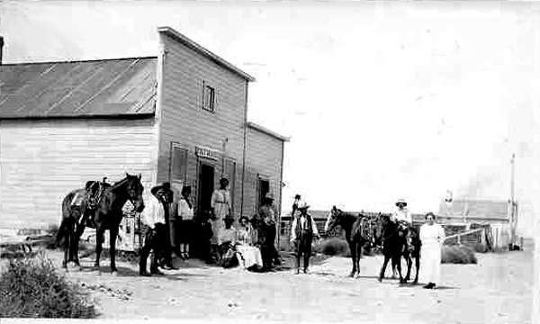
DeHoff & Son Grocery, Node, Wyo., 1914
Node, to the east of Lusk, derived its name from the
Node Ranch, sometimes referred to as the "Flying E." "Node" refers to another brand held by the
ranch in the shape of a knot or node.
When the ranch was started is somewhat unclear.
It is shown on an 1891 map of Wyoming and was a railroad stop. However, a
post office was not established until 1910 when Peter Hansen was designated as
postmaster. He maintained the
office at his homestead. The post office was later moved to the DeHoff Grocery. Today, the town has minimal
population.
Other towns near Lusk which have seen better days include Manville 16 miles to the west, Keeline, Lost Springs, and
Shawnee.
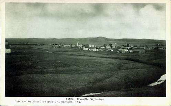
Manville, undated
To the west of Manville, lies Keeline. Like Lusk and Manville, it received its
start when the Railroad came through in 1886. George A. Keeline, originally ran cattle in
Colorado in the 1870's, before he moved to Wyoming. The Keeline Ranch was headquartered in the
Thunder Basin, further to the north.
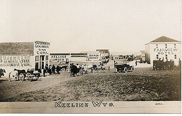
Keeline, 1915
To the west of Keeline, in Converse County, lies the smallest incorporated
municipality in the United States, Lost Springs, population 1, 4, or 5, depending on who is
doing the counting. The 2000 census only reflected 1, the mayor. However, it is contended
that the census missed the three councilmen. At one time, the town had a
population of about 150, but with the end of the Lance Creek oil boom, population declined. Today, the
town consists of the Town Hall, an antique store located in the old bank building, a saloon open on
major holidays and during hunting season, an outhouse, the old jail (not occupied during the
past 40 years), and several other
buildings in varying states of decrepitude. As a word of explanation, Wyoming provides revenue sharing
to its municipalities. Thus, Lost Springs receives funding from the state which has
paved its main street and helps to pay for the garbage service. The town was allegedly named by
railroad workers who were unable to find a spring shown on their maps. further to the
west is Shawnee.

Shawnee School, 2001, photo by Geoff Dobson
Next Page: Soddies and Dugouts.
|