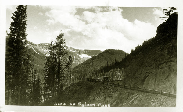
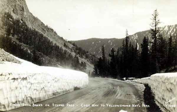
Ascending Sylvan Pass, approx. 1930.
In 1903, Park superintendent Hiram Chittenden described Sylvan Pass:
Sylvan Pass * * * takes its name from the lake, for there is nothing of a sylvan character in the pass itself.
On the contrary it presents a scene entirely unique among mountain passes.
It is like a vast trough, the sides of which are composed of loose rock
that has fallen down from the lofty cliffs above, and now rests on its
natural slope, forming a treacherous foothold even for the wild animals
of the mountains. The great natural obstacles in crossing it have always
prevented it from being much used, either by wild game or the Indians, and
it was not until after extensive exploration that the government engineers
finally selected it for the line of the Eastern Approach across the Absaroka
Divide. Two considerations at length prevailed over the enormous difficulties
of the work—the fact that the pass was nearly 1,000 feet lower than any
other available, and the unique and unusual character of the scenery.
At the very summit of the pass, a rippling waterfall comes down from the
cliffs on the south, and flows into a little pond of great clearness and
depth. Owing to the loose texture of the rock-filled ravine, a large part
of the water that enters this pond flows away by subterranean passages, and
it is full to overflowing only during the spring high water. By the end of
the tourist season it falls nearly ten feet.
The pass is flanked by lofty mountains—Avalanche Peak and Mount Hoyt on the
north, and grizzly and Top Notch Peaks on the south. They rise directly
from the pass to heights of from 1,000 to 2,000 feet.
Descending from the pass by a steep grade, the road arrives, in about a
mile, at a crystal fountain which is probably the largest cold water
spring in the park. It gives egress to the waters which flow out of Sylvan
Pass.
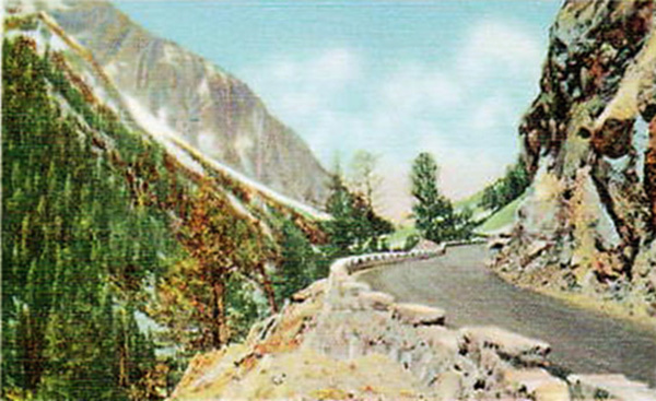
Sylvan Pass, approx. 1920's.
The pass is some 8,524 feet in elevation and provides a first views of Avalanche and Hoyt Peaks to the north,
Top Notch Peak to the South, and Sylvan Lake from which the pass derives its name. One may also
spot the Grand Tetons seventy miles away. In the 1902 Haynes Guide to Yellowstone, it was noted that
on the descent from Sylvan Pass after
pass was reached "one of the finest panorama views of the Park is to be had. Yellowstone Lake occupies the
foreground, and the distant snow-clad peaks of the Tetons, Quadrants,
Electric Peak, Mount Washburn, and the entire Rocky Mountain range within
the Park, outline the horizon." The Guide noted, however that it qas about eighteen miles from the Lake Hotel to Sylvan Pass. Thus, the Guide warned
that although a side trip to this rugged portion of the Park was now
possible " until hotel accommodations are provided, it will be necessary to carry camp equipment,
as it will require nearly two days to visit all the interesting points of this section."
Avalanche and Hoyt Peaks, National Park Service Photo.
Hoyt Peak is named after Governor Hoyt who explored the area, looking for a route to connect Yellowstone to the rest of
Wyoming.
Sylvan Lake, approx. 1927.
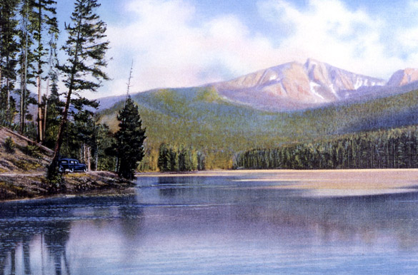
Sylvan Lake. Postcard by Haynes, approx. 1930.
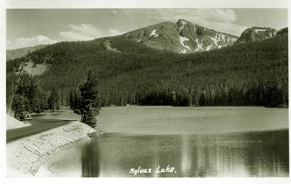
Sylvan Lake, approx. 1930.
From the above two photos it is not dificult to see how Top Notch Peak received its name.
The loose rocks referred to by Superintendent Chittenden in the pass are seen on the two preceding pages.
The loose rocks still
provide problems. The road passes below a sharp precipice of loose rocks or talus.
Sylvan Pass with icy conditions, 1930's. Photo by William Sanborn.
Under wet conditions the mud, talus and
gravel slide down onto the road imperiling motorists.
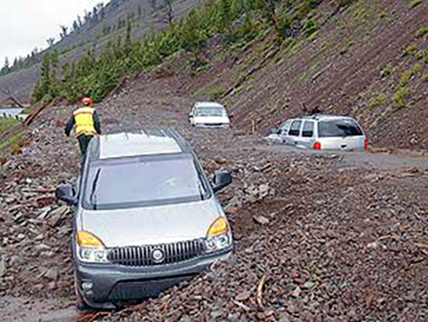
Vehicles overtaken by gravel side, Sylvan Pass. National Park
Service Photo.
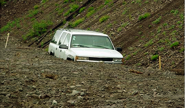
Vehicle overtaken by gravel side, Sylvan Pass.
NOAA photo.
The area can receive as much as 300 inches of snow a year. As a result, in the winter the road is frequently closed as a result of avalanche danger.
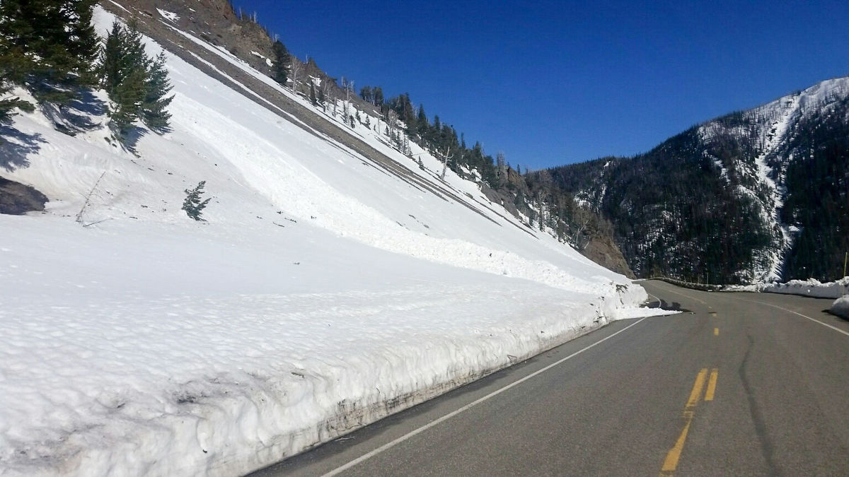
Site of avalanches, Sylvan Pass, May, 4, 2017. National Park Service Photo.
The above photo shows the area in which during one 10-hour period in May 2017 some four
avalanches reached the road.
Next Page: Promotion of the Cody Road.
|