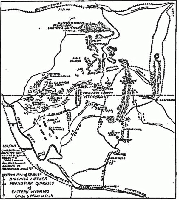
Sketch map of the Spanish Diggings by Robert R. Gilder, 1906.
Nebraska, 1906.
South of Manville, Jireh, Lost Springs, Keeline is am area extending into Platte County and Goshen County north pf Hartville.
The area is bounded on the east by the Rawhide Buttes, the Haystack Range and on the west
by an area known as the " Spanish Diggings." The Spanish Diggings themselves are an area in the Southwest corner of
Niobrara County extending across the south county line into northeastern Platte County.
It is an area of canyons such as Muskrat Canyon, Dead Horse Canyon and Whalen Canyon.
In Whalen Canyon there are a number of caves showing signs of previous human habitation. Thus rumors arose that
Whalen Canyon had been used as a hideout for the infamous
Jack Slade and his gang. Muskrat Canyon is an area of abandoned mines. Access from the horth even today is difficult.
In the summer, streams such a Muddy Creek and Spanish Creek are subject to unexpected flash floods. Indeed, in
early June 2015 roads into the area such as Jireh Road and Spanish Diggings Road were washed out in areas rendering access
to the area even more unaccessbile.
Even as late as the early 1900's the area
was basically unexplored.
More remarkable, however, is the presence of numerous tipi rings.
An early visitor to the area investigating Muskrat Canyon as an investment for copper mining later wrote:
Our destination was Muskrat canyon. 25 mUes distant, and for six hours,
our team of heavy draft horses plodded ahead without any apparent anxiety
as to how long it would take them to cover the distance. Far ahead of us,
Rawhide Buttes were outlined dark and gloomy aga'nst the southern sky.
Then as night came on with our journey only half completed, we were under
a starlit sky such as 1 have never seen elsewhere, except in Arizona and
New Mexico. It was somewhat after nine o'c'ock when we finally climbed
down from the wagon and opened up the shanty, built a fire and started
in to prepare something to eat and then to make ourselves comfortable
for the night. It was cool for we were a mile and a quarter above sea
level, and the stillness, outside our little group, was oppressive.
Later in the evening, while chatting and smoking around the welcome fire,
I asked the superintendent if he had ever noticed any
aboriginal remains in the vicinity. He replied that the level
meadows in the canyons and on the low mesps were almost covered with
scores and hundreds of stone rings, and that the Indians of today have
no theory as to the origin of these antiquities.
* * * *
I measured a number of these rings and found them to range from ten to
twenty feet in diameter, almost every size between these extremes being
in evidence, but the majority of them approximate 16 feet. In some cases,
a large and small circle were noticed close together with an aisle or
stone enclosed walk connecting the two. I examined very carefully, t
he surface enclosed by these stone circles, and found numerous crude
scrapers chipped from jasper and chalcedony which materials are very
plentiful in the surrounding hills. I could find no other implement or
weapon except the rude hide scrapers above referred to, and this seemed t
o indicate that much dressing and tanning of hides had been carried on i
n these old villages.
The following day, 1 visited and mapped another large group of
exactly the same kind of remains on the level mesa top that stretches
between the mouth of Wildcat canyon and Rawhide creek, distant about
three miles from our camp Covering an area of perhaps 160 acres, it
was impossible to find an open space of 50 feet between the rings,
which will give some 'dea of their number. I was told by people
familiar with the country, that these village sites can be found on
almost any level tract of land, especially if in the neighborhood of a
creek or spring. I had confidently counted on another day In this
fascinating region with the idea of making some excavat'ons, but
during the last night we were in camp, it suddenly turned cold and
began to snow, making it impracticable for us to tarry longer with the
limited supply of provisions on hand. We had hoppled our horses the night
before and turned them out to graze, and with the snowfalling and the
wind blowing forty miles an hour the next morn'ng. we were obliged to
do considerable walking before we found the team. Then a very disagreeable
ride of five hours directly against the storm brought us to the railroad
again. itus, W. A.: "Prehistoric Village Sites in Eastern Wyoming,
"The Archeaogical Bulletin, July-August, 1914.
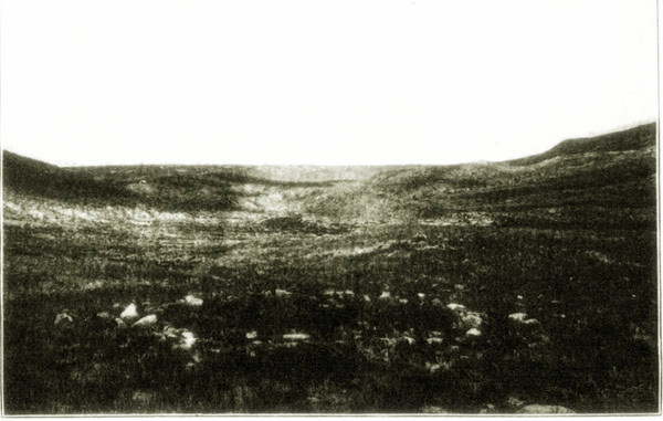
Tipi Rings near the Spanish Diggings, c. 1908, photo by
Robert F. Gilder.
Most remarkable, however, is that the site covering 40 square miles constituted one giant workshop
for making various stone, quartize and flint tools, such as arrow heads and scrapers. In addition other
remants left by Native Americans were found.
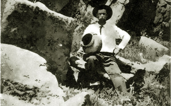
Jug found in Spanishh Diggings, 1915.
In 1906, Robert F. Gilder, an Omaha newspaper writer explored the
Spanish Diggings south of Manville. He had been inspired by earlier writings of
George A. Dorsey (1868-1931) and Robert Stewart Culin (1858-1929). See Culin, Stewart: Bulletin of the
Free Museum of Science & Art, University of Pennsylvania, Jan. 1901, and Dorsey, George: Field Columbian
Museum Publication 51"An Aboriginal Quartizite Quarry in Eastern Wyoming," Dec. 1900, which described their 1900
trip into the area.
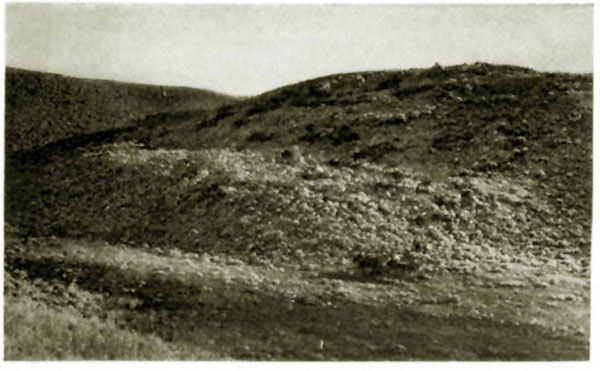
Spanish Diggings, Photo from the Dorsey and Culin 1900 expedition.
Culin and Dorsey were guided into the area by two local ranchmen and prospectors
William Lauk (1853-1935) and Joseph Stein (1851-1935) who had claims north of Hyattville near
Sunrise. Whalen Canyon where the two resided was rumored to be the an area in which the infamous
Jack Slade had hidden his loot. Stein had come to the area about 1881 and allegedly became a partner of an individual
who claimed to have been a member of the Slade gang. The two searched for the cache. One day, so the story goes,
the partner went out on a burro but never returned. It was said that the partner was later seen
at Ft. Laramie spending money as if it was going out of style and then disappeared.
Did the partner find Slade's gold and cut Stein out of his share? Is the story true? We will never
know.
George A. Dorsey, Spanish Diggings, 1900.
At the time of Culin's visit, Stein was already becoming disgusted with growth in the area
as a result of the Sunrise Mining Camp. As described by Culin in his account:
Messrs. Lauk and
Stein, were interesting characters. They had taken up their land
some nineteen years ago, when wandering bands of Sioux fre-
quently crossed the cafion, bear and antelope abounded, and the
trees still bore their burdens of Indians buried amid their
branches. Stein, in particular, was very bitter against the en-
croachments of civilization. He rejoiced, he said, in nature un-
contaminated by man. Now it was necessary to lock the cabin
door. Formerly theft was unknown. A stranger would come,
pass the night, cook his supper from the stores, and depart leaving
all else untouched. Another railroad, the Chicago, Burlington &
Quincy, was being completed into Guernsey. The gangs were
working on its embankments and the great piles of posts were
there in readiness to fence off its track. The hills on every
side were scarred with the trenches and shafts of the prospec-
tors for the iron ore that had led a competing railroad to race to
the incipient town. The two partners had sold their claims
and intended to remove to the wilderness, where they hoped to
live undisturbed by railroads until their days were ended.
Ultimately the two filed for separate homesteads just across the county line in
Platte County. The adjacent homesteads were proved up in 1918. Lauk died in
April 1935 and Stein died six months later. Both are buried in the Wheatland Cemetery.
Two years earlier another old prospector from the area Mauritz Aronstein died. His body was discovered when persons traveling
the Rawhide Buttes road noticed a small dog on a knoll near
Muskrat Canyon. The dog was observed to have stood in place for a week. As anybody passed, the dog barked as if to get
the attention of the passer-by. Someone finally investigated to see what the dog wanted. Aronstein was found near his mine dead.
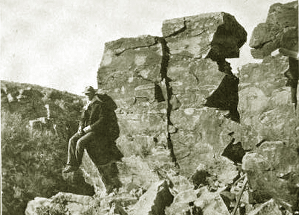
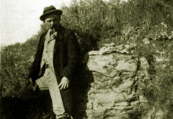
Spanish Diggings, Photo by Charles H. Merrill, University of
Nebraska, 1906.
Next Page: Spanish Diggings Continued.
|