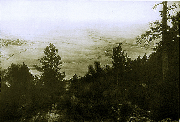
Great Plains as viewed from top of Rawhide Buttes, photo by
Robert F. Gilder, 1909. The horizon is about 60 miles away.
The area was (and is) cutoff from the east by
Rawhide Buttes, from the south by the North Platte River and from the west by an area known as the
"Spanish Diggings." The Great Plains stretch westward from the
Missouri River marking the eastern border of Nebraska until they reach the abrupt rise of
Rawhide Buttes.
The headwaters of Rawhide Creek are to the southwest of the Buttes and beyond the Buttes is an escarpment. Along the Creek were
Russell Thorp's Rawhide Ranch and the Nine Bar Ranch operated by Wesley W. Wolfe & Son.
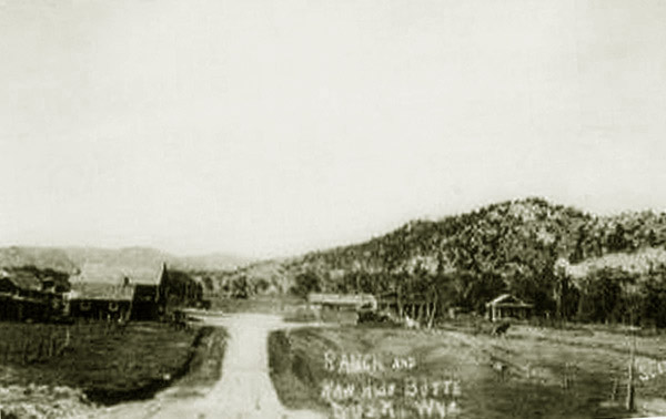
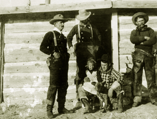
Ranch at Rawhide Buttes, c. 1910.
The Nine Bar from about 1905 to 1920 achieved some fame as a result of being featured in the writings of
Gilder and William Rheem Lighton both of whom stayed at the Nine Bar. Gilder, a writer for an
Omaha newspaper restarted an earlier career as an artist at the Nine Bar. Lighton was the author of the Billy Fortune series
which appeared in the Saturday Evening Post and Sunset Magazine, a regional magazine published by the
passenger department of the Southern Pacific Railroad. Lighton's wife, Laura, was a first cousin of the ranch foreman Dan Chalfant.
The backdrop of the estimated fifty Billy Fortune stories was the area around southern Niobrara County and
conflict between homesteaders, ranchers, and sheepmen.
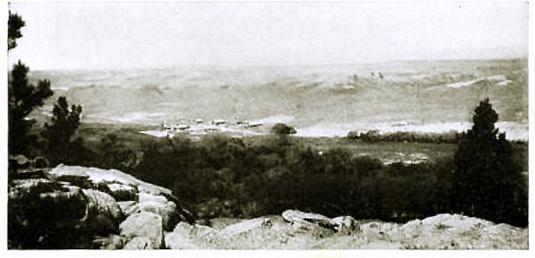
Looking west from top of Rawhide Buttes, photo by
Robert F. Gilder, 1909.
The central character of the Billy Fortune stories was modeled after Chalfant whom Lighton later compared to Will Rogers. The
stories appearing in Sunset Magazine were illustrated by Arthur Cahill who came to the
the Nine Bar to authentically illustrate the scenes. The Staturday Evening Post stories were illustrated by Harvey Dunn.
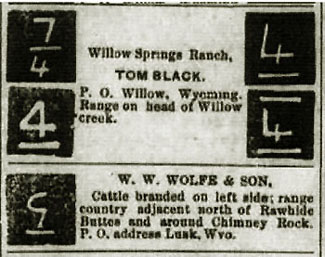
In the stories local names were dropped such as that of Tom Black, whose ranch was on Willow Creek some six miles back of the
beyond of the escarpment west of Rawhide Creek.
Left, W. R. Lighton; Right, Arthur Cahill
In the early years of the 20th Century about six miles back of the
beyond represented by the escarpment was Willow Creek and Tom Black's Willow Springs Ranch. Former Deadwood Stage driver George Lathrup lived out his final years
in a cabin on the Willow Springs Ranch.
Tom Black with some of his cowboys.
Tom Black, himself, had been station manager for the
Running Water Station for the Deadwood Stage. Tom proved up his homestead in 1892 but even as late as 1932 at the time of
Tom's death the area remained isolated. Tom's daughter on receiving word of her father's deathbed had to
come in by bobsled. His brother Masons from the Manville and Lusk Lodges had to take shovels
in their trucks to dig their way in to bring Tom's remains back to Lusk for
the Masonic services.
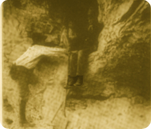 
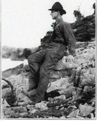
Left: Robert Robert Gilder sitting in entrance to Cave. Harlan L. Smith, Amercian Museum of Natural History climbing up. Right:
Brands for the Nine Bar and for Tom Black's Willow Springs Ranch
Harlan Smith visted the caves during 1907 and 1908. He later described the caves in his 1910 "An Unknown Field in American Archeology,"
Bulletin of the American Geographical Society, Vol. 42, No. 7, pp. 511:
In one of
the caves in eastern Wyoming was a great accumulation of debris,
and in front of it were tipis circles and more evidence of village
debris than I saw elsewhere in the State. The top of the refuse in
the cave was strewn with the bones of sheep and cattle, probably
dragged there recently by wild animals. The presence of picto-
graphs near the cave and of the unusual traces of habitation in front
of it, led me to believe that the lower layers of cave refuse might
contain human remains or manufactures, thus holding evidence for
a knowldge of these Wyoming cave dwellers. For this reason I
have recommended the caves as one of the more promising fields for
future exploration.
Some distance to the west of Willow is Flattop Butte and to its south are the "Spanish Diggings."
The Diggings were not Spanish at all but are instead one of the largest
collection of Native American quarries and tipi rings in the United States. The area west of
Willow was described by Gilder (1856-1940), in "The 'Spanish Diggings,' Wyoming,"
Records of the Past Magazine, Jan-Feb, 1909, as an area of "extreme wilderness, completely given over to
wild range cattle and predatory animals, where the 'whir-r-r' of the rattlesnake greets one's
ears daily and where few people go for pleasure." Indeed, even today, it is much the same.
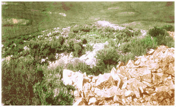
Spanish Diggings.
In 1956, Mae Urbarek described the isolation of the Spanish Diggings:
Although a large sign describing the Spanish Diggings is
located on Highway 20, three miles west of Keeline, no road over
which modern cars can travel leads to the main diggings from this
direction. The main quarries are approximately sixteen miles
south of the sign. Owners and lessees of the land surrounding the
quarries do not encourage tourist travel. In the past they have
had their water tanks plugged with bullets, their cattle scared,
their fences torn down, and their gates left open. It is very diffi-
cult for a stranger to find the pits and workshops of Spanish
Diggings.
The easiest approach to them is from a graveled road which
turns off from Highway 87 one mile north of Glendo, and runs
east to Meadowdale, an inland store and postoffice. Nine miles
east of Glendo, or nine miles west of Meadowdale, the traveler
should turn north through an auto gate or cattle guard where a
sign lists the names of Roy McCormick, Douglas Lay, and Bill
Ziska. An ungraded and unmarked road leads north and east
through fields and farm yards for six miles to where a dim trail
turns left to the top of a hill where there are three government
geological stakes. The main quarries are about a mile east of
these stakes. Urbanek, Mae: "Stone Age Industry in Wyoming," Annals of Wyoming, XXVIII, 2 (October 1956), 119-126.
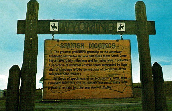
Sign for Spanish Diggings Road of which Mrs. Urbanek wrote, approx. 1956.
The post office and store at Meadowdale are now missing. Meadowdale, once a center of
dry farming, is now merely an intersection of two lonely roads.
With the advent of
dry farming south of Willow Creek, the small "town" of Flattop arose about 1914. The town named after the nearby butte consisted of
a post office and store, the Flattop Supply Co. The store and the post office
was initially operated by Washington I. Funk (1871-1921) who was appointed as the initial postmaster.
.Funk homesteaded the property. Funk had come to the area from Nebraska. Shortly after establishing the store the store was sold to H. L. Koontz. In 1917,
he brought foreclosure proceedings. It was apparently difficult to make money in the area. in 1917,
Funk foreclosed on the chattle mortgage. Ultimately D. T. Davis took over operation of the
store and post office. At first mail was brought to Flattop from Jireh and subsequently from
Keeline and Lost Springs. In the winter, mail came by bobsled. The Guernsey Gazette,
April 4, 1919, noted that the area of Flattop was isolated by many miles of bad roads or no roads. The store remained unprofitable.
In May 1921, D. T. Davis who operated the store was convicted of embezzling
postal funds in order to support the store. He was sentenced to 15 months in Federal Prison. The post office finally closed on February 28, 1954.
In 1916, the Funks' daughter who had moved to Marshaltown, Iowa, with her husband and four-year old son died unexpectedly
from pneumonia. Thus, the elder Funks received custody of their grandson.
The Funks moved back to Sioux County, Nebraska, where W. I. Funk died in 1921.
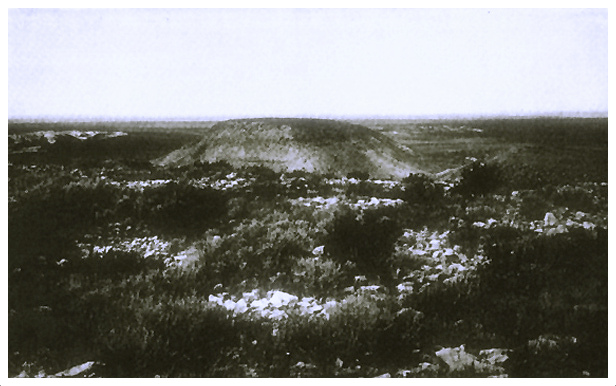
Foreground, Spanish Diggings, Flattop Butte in center to the north, photo by
Robert F. Gilder, C. 1908.
The Spanish Diggings were discovered in 1879 by Addison Spaugh when he was working for the OW as a young
trail boss. In 1915 in a letter to C. H. Robinson, Spaugh described its discovery:
In 1879 I was working my way across the country to the Laramie Plains to
the head of Old Woman Creek, 15 miles northwest of where Manville now
stands, with a herd of cattle which we to be located on the head of Old
Woman Creek at what is known as the OW Ranch�having located and started
that ranch�we crossed the mountains just east of Laramie Peak, crossed the
the Platte River just east of the month of the Muddy Creek, coming up the
divide between the Main Creek and East Muddy, or what is known now as
Spanish Diggings Creek. We camped on the head of this last named creek
for the night. The next morning some of our horses were missing. In looking
for our horses I discovered these excavations, which I believed at the
time to be an old Spanish mine and reported the finding to Mr. A. R.
Converse, who was the president of the First National Bank at Cheyenne at
that time and was interested in the cattle which I was moving from the
Laramie Plains to the OW ranch and Mr. Converse, took the matter up with
some other people and there was some little publicity in Cheyenne at that
time about the discovery. Robinson, C. H.: "A travelogue on Uncommercialized Archeologial Resouves in Southestern
Wyoming During the Month of August, 1914", the Archeological Bulletin, March-April, 1916.
Next Page: Soddies.
|